
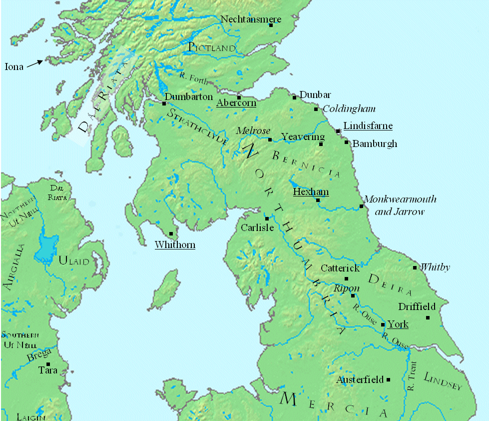
Image: Northern central British Isles c 700
Size of this preview: 697 × 599 pixels. Other resolutions: 279 × 240 pixels | 979 × 842 pixels.
Original image (979 × 842 pixels, file size: 407 KB, MIME type: image/gif)
Description: This is a map showing the north central British Isles in the late seventh century. The file was created using DMIS. On that site it is stated that "We do not claim copyright on the images, so you can use them for Wikipedia." Sources include (for Great Britain) a map found in Peter Hunter Blair's "Roman Britain and Early England: 55 B.C.-871 A.D.", W.W. Norton, 1963, p. 209; and (for Ireland) on a map in Duffy's Atlas of Irish History.
Title: Northern central British Isles c 700
Credit: Transferred from en.wikipedia to Commons by CatMan61 using CommonsHelper.
Author: Mike Christie at English Wikipedia
Usage Terms: Public domain
License: Public domain
Attribution Required?: No
Image usage
The following page links to this image:

All content from Kiddle encyclopedia articles (including the article images and facts) can be freely used under Attribution-ShareAlike license, unless stated otherwise.