
Image: OKCTornado2

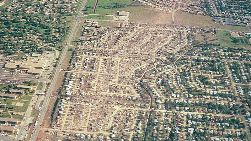
Description: Tornado damage in Del City near the Sooner Road/Del View Drive intersection, facing southward – Tinker Air Force Base is off the left edge of the viewable image, and the primary road running from top to bottom on the left side is Sooner Road. To the right of the road is Del City, and to the left of the road is Oklahoma City. There are multiple left-right roads in this image; the one running from Sooner Road all the way to the right side of the image (it is nearest the top) is SE 44th Street. All the land beyond that road is also part of Oklahoma City.
Title: OKCTornado2
Credit: Own work
Author: Xpda
Usage Terms: Creative Commons Attribution 3.0
License: CC BY 3.0
License Link: http://creativecommons.org/licenses/by/3.0
Attribution Required?: Yes
Image usage
The following page links to this image:
