
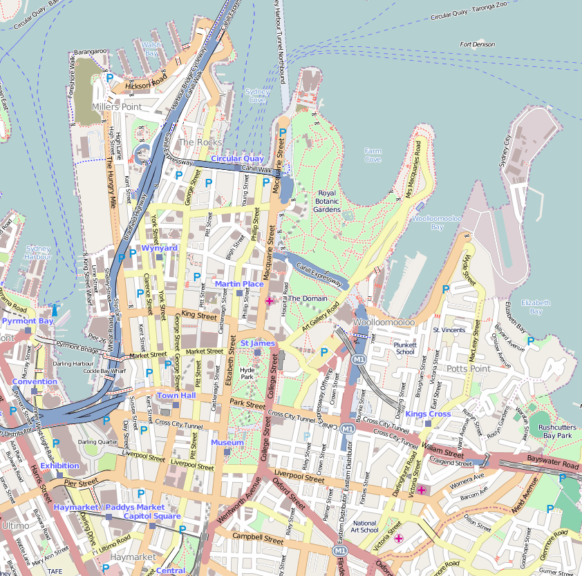
Image: OSM central Sydney
Size of this preview: 605 × 599 pixels. Other resolutions: 242 × 240 pixels | 842 × 834 pixels.
Original image (842 × 834 pixels, file size: 621 KB, MIME type: image/png)
Description: Central Sydney mapped by Open Street Map. Bounds (approx) (top: -33.8528, base: -33.8832, left: 151.1960, right: 151.2320).
Title: OSM central Sydney
Credit: http://www.openstreetmap.org/#map=15/-33.8699/151.1983
Author: © OpenStreetMap contributors
Usage Terms: Creative Commons Attribution-Share Alike 2.0
License: CC BY-SA 2.0
License Link: https://creativecommons.org/licenses/by-sa/2.0
Attribution Required?: Yes
Image usage
The following 15 pages link to this image:
- Bennelong Point
- Capitol Theatre, Sydney
- Circular Quay
- Dawes Point Battery
- Fort Phillip (Sydney)
- Great Synagogue (Sydney)
- Mrs Macquarie's Chair
- Pitt Street Uniting Church
- Queen's Square, Sydney
- St Andrew's Cathedral, Sydney
- St Brigid's Roman Catholic Church
- St Mary's Cathedral, Sydney
- Sydney central business district
- Tank Stream
- Wynyard, Sydney

All content from Kiddle encyclopedia articles (including the article images and facts) can be freely used under Attribution-ShareAlike license, unless stated otherwise.