
Image: Oettingen Counties 1744
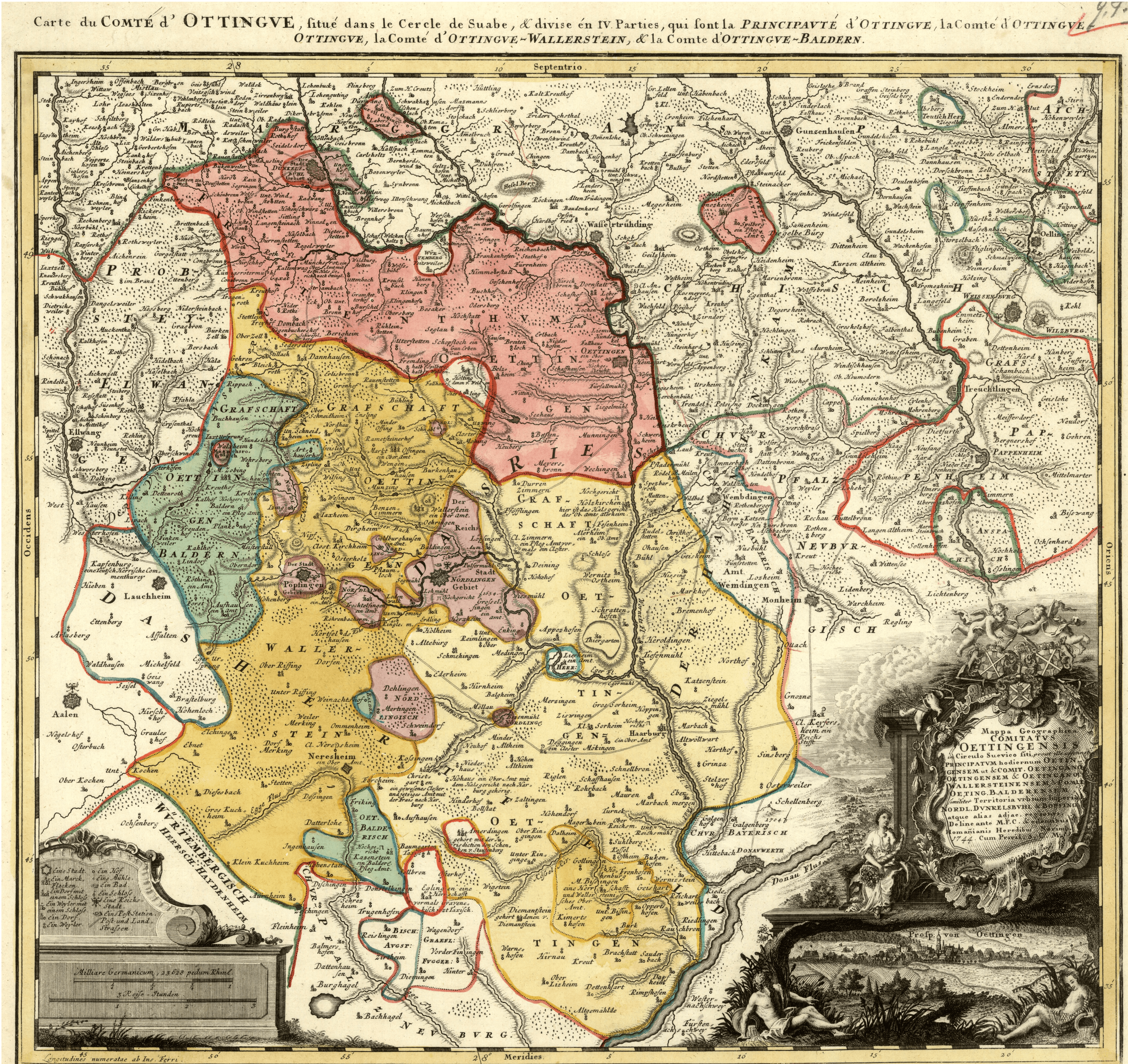
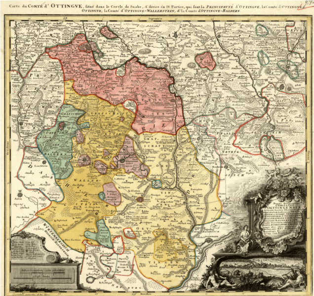
Description: Map showing the territories of the House of Oettingen in the mid-18th century: the Principality of Oettingen (or Oettingen-Spielberg, in pink) and the Counties of Oettingen-Oettingen (light yellow), Oettingen-Baldern (aqua) and Oettingen-Wallerstein (yellow). Also shown (in purple) are the territories of the free imperial cities of Nördlingen (with its half-dozen exclaves), Bopfingen and Dinkelsbühl. The map, which contains information in Latin, French and German, was designed by M. F. Cnopf and published by Homann Erben (Homann Heirs) in 1744.
Title: Oettingen Counties 1744
Credit: Moll's map collection
Author: M. F. Cnopf - Homann Heirs
Usage Terms: Public domain
License: Public domain
Attribution Required?: No
Image usage
The following page links to this image:
