
Image: Ohio-scioto lands
Size of this preview: 482 × 600 pixels. Other resolutions: 193 × 240 pixels | 540 × 672 pixels.
Original image (540 × 672 pixels, file size: 188 KB, MIME type: image/png)
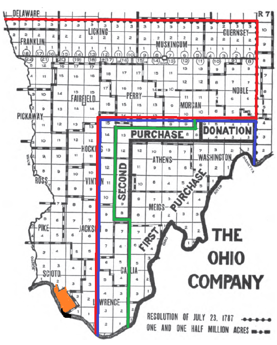
Description: This map shows lands in Ohio which the Scioto Company (red) intended to buy, the lands the Ohio Company of Associates (blue) intended to buy, the lands the Ohio Company did buy (green), and the French Grant (orange).
Title: Ohio-scioto lands
Credit: The map is adapted by Roseohioresident (talk) 15:59, 7 August 2010 (UTC) from Peters, William E. (1918) Ohio Lands and Their Subdivisions, W.E. Peters, pp. 244
Author: William E Peters
Usage Terms: Public domain
License: Public domain
Attribution Required?: No
Image usage
The following 3 pages link to this image:

All content from Kiddle encyclopedia articles (including the article images and facts) can be freely used under Attribution-ShareAlike license, unless stated otherwise.