
Image: Ohthere of Hålogaland's travels
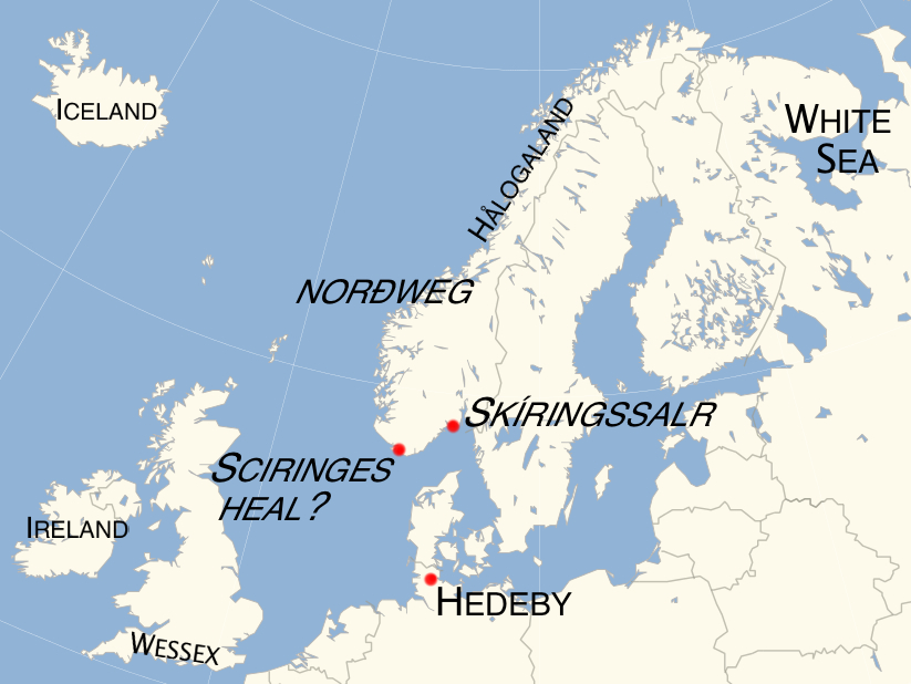
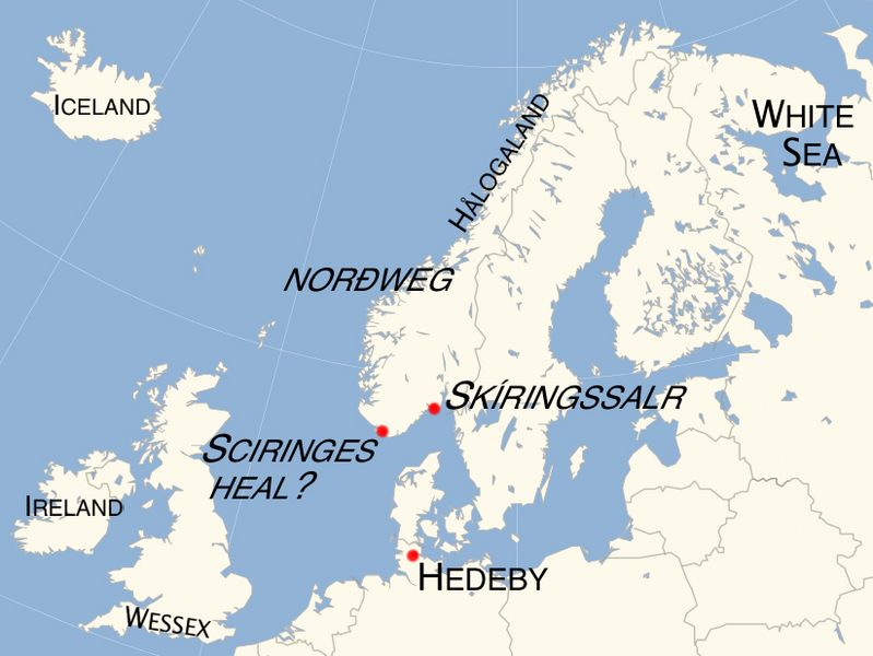
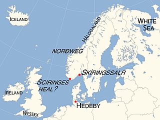
Description: Map showing principal places mentioned in Ohthere of Hålogaland's account of his travels, as given to King Alfred of Wessex around 890 AD: note that "White Sea" indicates the general location of the land of the Beormas, which may have lain on either the eastern or the western side of the White Sea; that Skíringssalr, a historical location near Larvik, has commonly been assumed to be the location of the Sciringes heal mentioned by Ohthere, but that this is disputed in favour of a location slightly west of Lindesnes, at the southern tip of modern Norway; that opinion is divided over whether Ohthere's account originally referred to Ireland or Iceland; and that political boundaries shown on this map are modern, having no bearing on the status quo at the time of Ohthere's travels.
Title: Ohthere of Hålogaland's travels
Credit: Own work, based on part of File:Europe polar stereographic Caucasus Urals boundary.svg
Author: Nortonius
Usage Terms: Creative Commons Attribution-Share Alike 3.0
License: CC BY-SA 3.0
License Link: https://creativecommons.org/licenses/by-sa/3.0
Attribution Required?: Yes
Image usage
The following page links to this image:
