
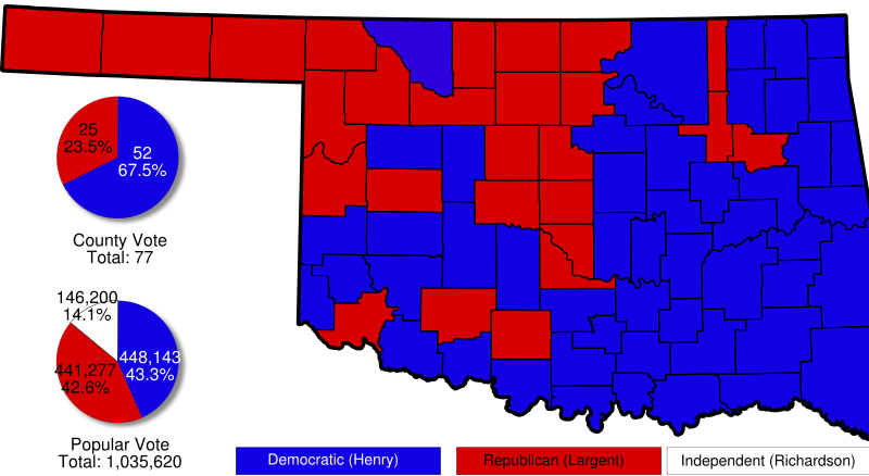
Image: Oklahoma 2002 gubernatorial election map

Size of this PNG preview of this SVG file: 800 × 438 pixels. Other resolution: 320 × 175 pixels.
Original image (SVG file, nominally 7,893 × 4,325 pixels, file size: 169 KB)
Description: A map of Oklahoma with pie charts and counties shaded to indicate voting in the 2002 gubernatorial election.
Title: Oklahoma 2002 gubernatorial election map
Credit: Based on Image:Map of Oklahoma highlighting Alfalfa County.svg by David Benbennick
Author: Scott Nazelrod
Permission: PD
Usage Terms: Public domain
License: Public domain
Attribution Required?: No
Image usage
The following page links to this image:

All content from Kiddle encyclopedia articles (including the article images and facts) can be freely used under Attribution-ShareAlike license, unless stated otherwise.