
Image: Old Portuguese map of SA 529
Size of this preview: 800 × 533 pixels. Other resolutions: 320 × 213 pixels | 3,456 × 2,304 pixels.
Original image (3,456 × 2,304 pixels, file size: 2.12 MB, MIME type: image/jpeg)
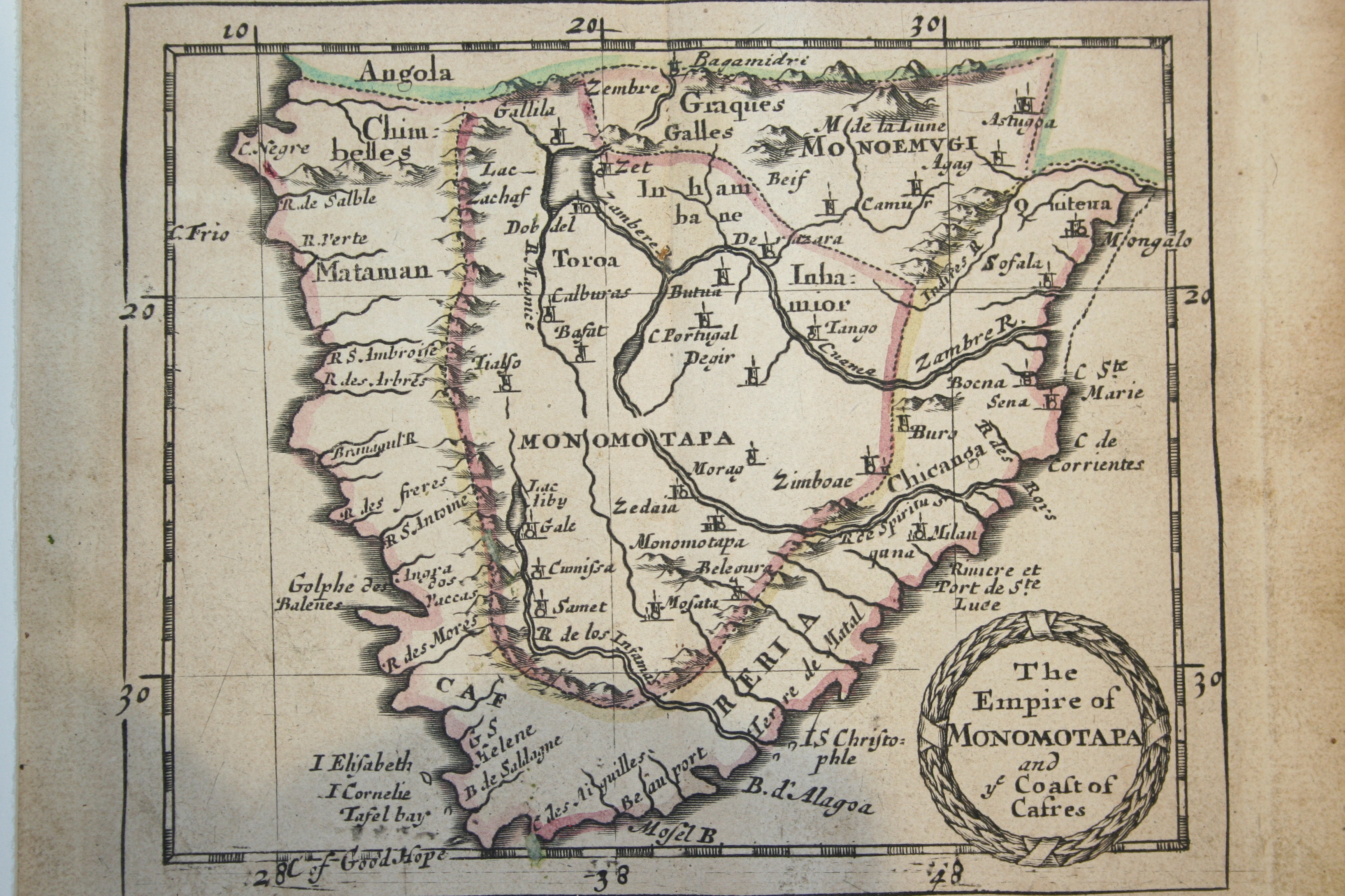
Description: A Portuguese map from what I think is the late 1500s/early 1600s of the Southern Coast of Africa and South Africa in particular. Picture is uncropped and of the whole map. Map of the Kingdom of Monomotapa in the 1600s where Christian missionaries encountered cross-dressing men known as chibadi. According to: Stewart, C. (2014, January 30). 21 varieties of traditional African homosexuality. Retrieved January 19, 2016, from http://76crimes.com/2014/01/30/21-varieties-of-traditional-african-homosexuality/ .
Title: Old Portuguese map of SA 529
Credit: Own work
Author: Discott
Usage Terms: Public domain
License: Public domain
Attribution Required?: No
Image usage
The following page links to this image:

All content from Kiddle encyclopedia articles (including the article images and facts) can be freely used under Attribution-ShareAlike license, unless stated otherwise.