
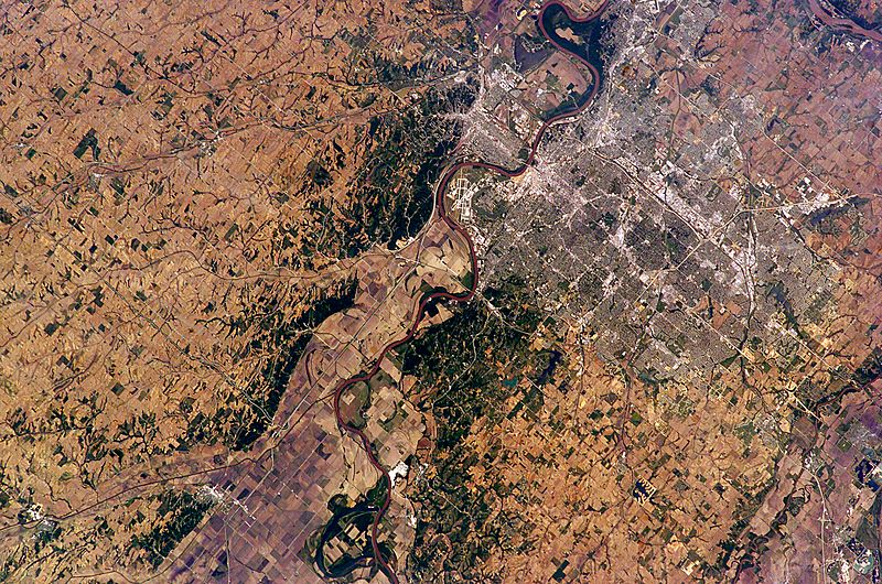
Image: Omaha and Council Bluffs on the Lewis and Clark Trail

Size of this preview: 800 × 530 pixels. Other resolutions: 320 × 212 pixels | 6,144 × 4,068 pixels.
Original image (6,144 × 4,068 pixels, file size: 20.17 MB, MIME type: image/jpeg)
Description: In this near-vertical view of Omaha—with a population estimated at more than three quarters of a million residents—the city is situated on high ground to the west of the Missouri River while Eppley Airfield and the town of Council Bluffs are located on the floodplain.
Title: Omaha and Council Bluffs on the Lewis and Clark Trail
Credit: NASA Earth Observatory
Author: Earth Sciences and Image Analysis Laboratory at Johnson Space Center
Usage Terms: Public domain
License: Public domain
Attribution Required?: No
Image usage
The following page links to this image:

All content from Kiddle encyclopedia articles (including the article images and facts) can be freely used under Attribution-ShareAlike license, unless stated otherwise.