
Image: Operation Chrome Dome route
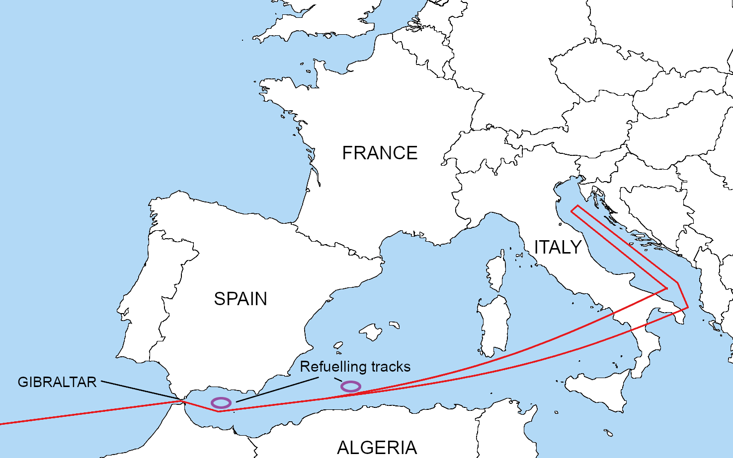
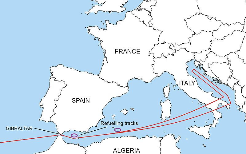
Description: This aircraft navigational route is the Eastern section of a 15,000 mile, 26 hour, round-trip airborne alert from Miami, (HAFB), threatening six targets in The Soviet Union. Note the two air-refueling tracks near Spain. At the 22 hour mark, west bound, upon receipt of the "GO CODE", the B-52H remains capable of reversing direction and reaching at least the first target without additional refueling. Thereafter, assuming survival, the flight plan continues across N. Africa, Brazil, to recover the aircraft at Edwards AFB, California.
Title: Operation Chrome Dome route
Credit: Transferred from en.wikipedia to Commons by Zscout370 using CommonsHelper.
Author: The original uploader was Emt147 at English Wikipedia
Usage Terms: Creative Commons Attribution-Share Alike 2.5
License: CC BY-SA 2.5
License Link: http://creativecommons.org/licenses/by-sa/2.5
Attribution Required?: Yes
Image usage
The following 2 pages link to this image:
