
Image: OsageTrail Independence Topo 1980red

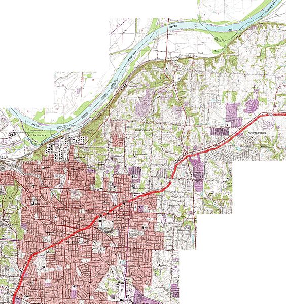
Description: Topographical map of much of Independence, Missouri, showing roughly the route of the ancient "Great Osage [Indian] Trail" through the region. The trail originates near central Missouri, Boonville and Franklin, Missouri, followed the route of modern U.S. 24 highway, and portions of modern Lexington Street and Westport Road in Independence, Missouri (the curved portions of each street in modern Independence, Missouri).
Title: OsageTrail Independence Topo 1980red
Credit: United States Geological Survey maps (public domain) at "TerraServer USA", USGS in cooperation with Microsoft via msrmaps.com, composite map is from USGS map "Independence, Missouri, United States 7/1/1995"
Author: I patch-worked together USGS sectional maps of the region online, such as the segment shown at http://preview.tinyurl.com/339hlmv, and added the blurry red line with MS (Microsoft) "Paint". While the maps are dated "7/1/1995", the data was originally collected and published in 1980.
Usage Terms: Public domain
License: Public domain
Attribution Required?: No
Image usage
The following page links to this image:
