
Image: Osman I area map
Size of this preview: 720 × 600 pixels. Other resolutions: 288 × 240 pixels | 816 × 680 pixels.
Original image (816 × 680 pixels, file size: 63 KB, MIME type: image/png)
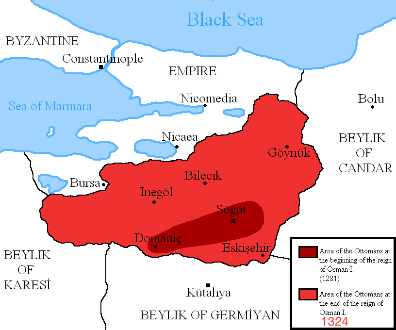
Description: Map showing the area of the Ottoman Empire during the reign of Osman I and his conquests. I used the information of various historical books and these maps:
http://aygunhoca.com/images/sunular/osman%20gazi%20dnemi.jpg
http://www.yalova.gov.tr/ortak_icerik/yalova.icisleri/yalova_tarihi%20(1).JPG
http://www.turkdiyalog.net/img/osmanli-devleti-kurulus-haritasi.jpg
Author: DragonTiger23
Usage Terms: Creative Commons Attribution-Share Alike 3.0
License: CC-BY-SA-3.0
License Link: http://creativecommons.org/licenses/by-sa/3.0/
Attribution Required?: Yes
Image usage
The following page links to this image:

All content from Kiddle encyclopedia articles (including the article images and facts) can be freely used under Attribution-ShareAlike license, unless stated otherwise.