
Image: Oso Landslide aerial

Size of this preview: 800 × 521 pixels. Other resolutions: 320 × 208 pixels | 2,907 × 1,893 pixels.
Original image (2,907 × 1,893 pixels, file size: 2.08 MB, MIME type: image/jpeg)
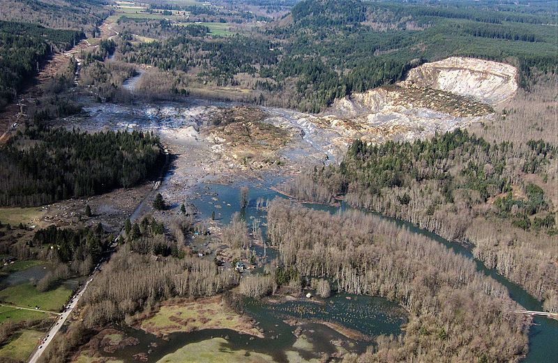
Description: Oblique aerial photograph of the 2014 landslide in northwest Washington. This image shows the entire extent of the landslide source area and path. This event is commonly named the “Oso Landslide” in many official reports. It is also referred to as the “SR530 Landslide,” as named by Snohomish County and Washington State. Credit: Mark Reid, USGS
Title: Oso Landslide aerial
Credit: https://www.usgs.gov/media/images/2014-landslide-washington-state-7
Author: Mark Reid, USGS
Usage Terms: Public domain
License: Public domain
Attribution Required?: No
Image usage
The following page links to this image:

All content from Kiddle encyclopedia articles (including the article images and facts) can be freely used under Attribution-ShareAlike license, unless stated otherwise.