
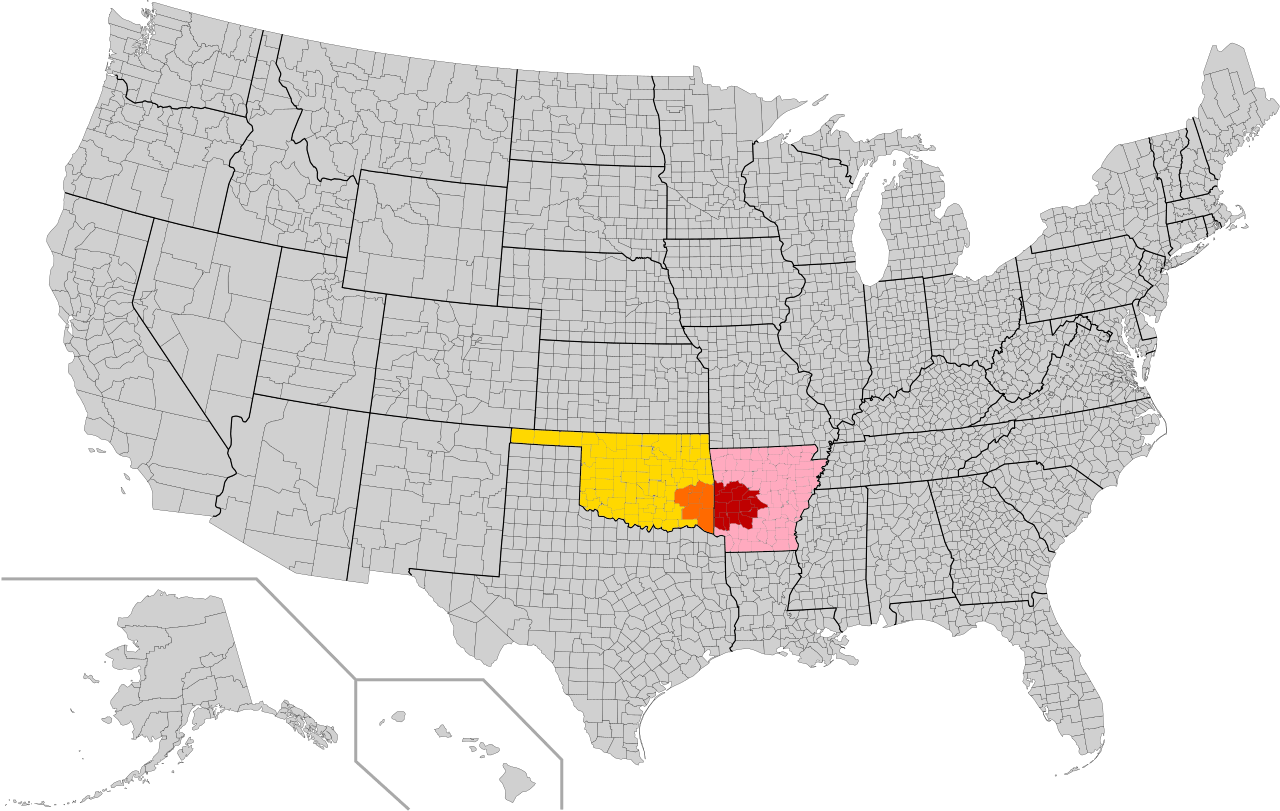
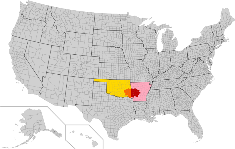
Image: Ouachita Mountains Counties Map
Size of this preview: 800 × 507 pixels. Other resolutions: 320 × 203 pixels | 1,280 × 811 pixels.
Original image (1,280 × 811 pixels, file size: 177 KB, MIME type: image/png)
Description: Counties in red are on the Arkansas side of the Ouachita mountains, while counties in orange are on the Oklahoma side. The rest of the state of Arkansas is in pink, and the rest of the state of Oklahoma is in yellow. Due to the way the county borders are drawn, it may not be entirely accurate.
Title: Ouachita Mountains Counties Map
Credit: Own work
Author: LegionaryIX
Usage Terms: Creative Commons Zero, Public Domain Dedication
License: CC0
License Link: http://creativecommons.org/publicdomain/zero/1.0/deed.en
Attribution Required?: No
Image usage
The following page links to this image:

All content from Kiddle encyclopedia articles (including the article images and facts) can be freely used under Attribution-ShareAlike license, unless stated otherwise.