
Image: Outline of Iceland Deformation Zones
No higher resolution available.
Outline_of_Iceland_Deformation_Zones.png (702 × 480 pixels, file size: 73 KB, MIME type: image/png)
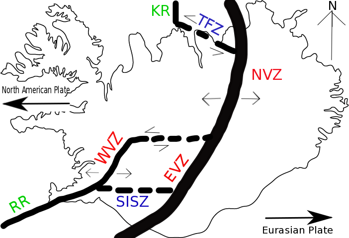
Description: Fig 1. This figure (not in scale) shows the outline location of the major deformation zones in Iceland. The thickest line represents the divergent plate boundary. RR, Reykjanes Ridge; WVZ, Western Volcanic Zone; EVZ, Eastern Volcanic Zone; NVZ, Northern Volcanic Zone; SISZ, South Iceland Seismic Zone; TRZ, Tjörnes Fracture Zone.
Title: Outline of Iceland Deformation Zones
Credit: Own work
Author: Ronlau817
Usage Terms: Creative Commons Attribution-Share Alike 4.0
License: CC BY-SA 4.0
License Link: https://creativecommons.org/licenses/by-sa/4.0
Attribution Required?: Yes
Image usage
The following page links to this image:

All content from Kiddle encyclopedia articles (including the article images and facts) can be freely used under Attribution-ShareAlike license, unless stated otherwise.