
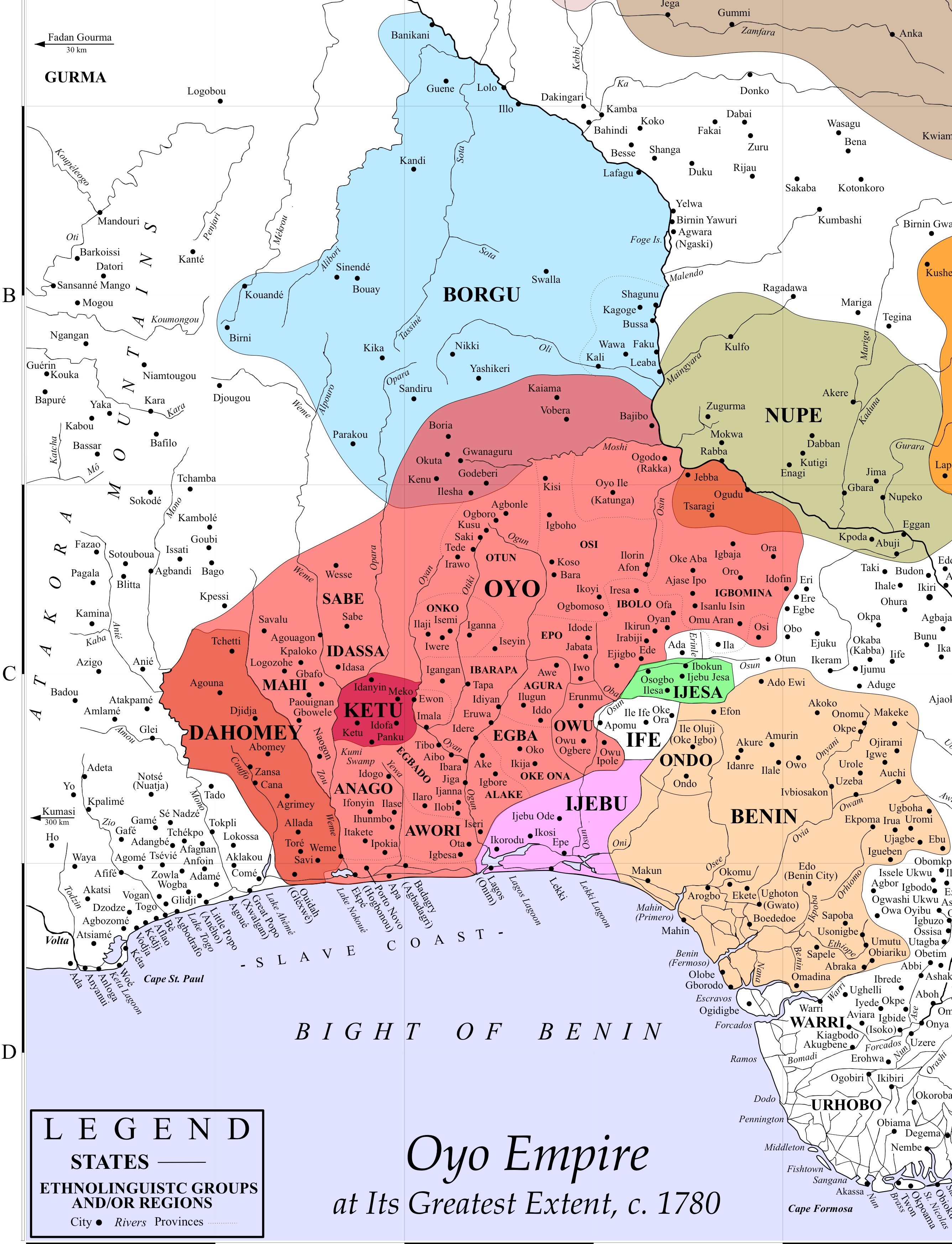
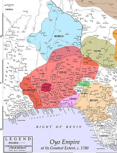
Image: Oyo Empire at Its Greatest Extent, c. 1780 (5)
Size of this preview: 459 × 599 pixels. Other resolutions: 184 × 240 pixels | 2,674 × 3,492 pixels.
Original image (2,674 × 3,492 pixels, file size: 1.63 MB, MIME type: image/jpeg)
Description: Oyo Empire at Its Greatest Extent, c. 1780
Title: Oyo Empire at Its Greatest Extent, c. 1780 (5)
Credit: https://hlovejoy.wordpress.com/maps-2/
Author: Source: Henry B. Lovejoy, “Re-Drawing Historical Maps of the Bight of Benin Hinterland, c. 1780.” Canadian Journal of African Studies 47, 3: 445.
Usage Terms: Creative Commons Attribution-Share Alike 4.0
License: CC BY-SA 4.0
License Link: https://creativecommons.org/licenses/by-sa/4.0
Attribution Required?: Yes
Image usage
The following page links to this image:

All content from Kiddle encyclopedia articles (including the article images and facts) can be freely used under Attribution-ShareAlike license, unless stated otherwise.
.jpg)