
Image: Ozark Highlands ecoregion, Level III
No higher resolution available.
Ozark_Highlands_ecoregion,_Level_III.png (244 × 185 pixels, file size: 40 KB, MIME type: image/png)
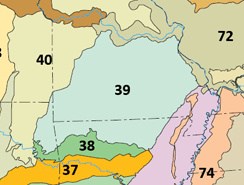
Description: Map showing the Ozark Highlands (39) ecoregion as defined by USEPA, with adjacent Level III ecoregions
Title: Ozark Highlands ecoregion, Level III
Credit: File:Level III ecoregions, United States.png
Author: Original File: United States Environmental Protection Agency Derivative work: User:Brandonrush
Usage Terms: Public domain
License: Public domain
Attribution Required?: No
Image usage
The following page links to this image:

All content from Kiddle encyclopedia articles (including the article images and facts) can be freely used under Attribution-ShareAlike license, unless stated otherwise.