
Image: PCN00414117000003020

Size of this preview: 800 × 342 pixels. Other resolutions: 320 × 137 pixels | 1,903 × 813 pixels.
Original image (1,903 × 813 pixels, file size: 493 KB, MIME type: image/jpeg)
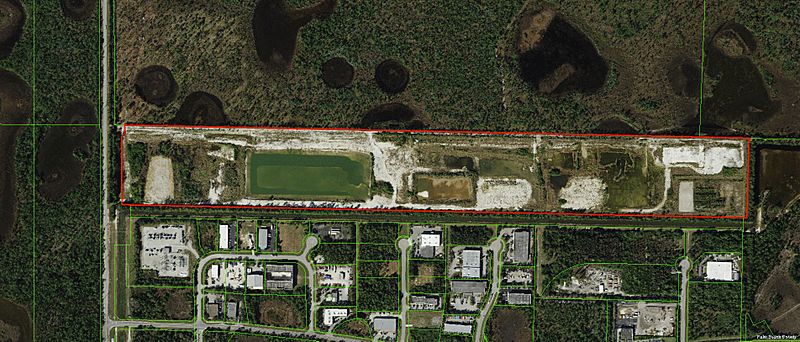
Description: Aerial photograph of 80-acre parcel of land in South Florida proposed to be developed with surf facility (outlined in red). Green lines depict parcel boundaries. Adjoining the property to the north (top of photo) is a wetland area. This photograph was generated on 11-10-2021 on the Palm Beach County Property Appraiser website.
Title: PCN00414117000003020
Credit: https://maps.co.palm-beach.fl.us/
Author: Palm Beach County Property Appraiser
Usage Terms: Public domain
License: Public domain
Attribution Required?: No
Image usage
The following page links to this image:

All content from Kiddle encyclopedia articles (including the article images and facts) can be freely used under Attribution-ShareAlike license, unless stated otherwise.