
Image: POLSKA mapa powiaty2

Size of this preview: 646 × 600 pixels. Other resolutions: 259 × 240 pixels | 1,021 × 948 pixels.
Original image (1,021 × 948 pixels, file size: 438 KB, MIME type: image/png)
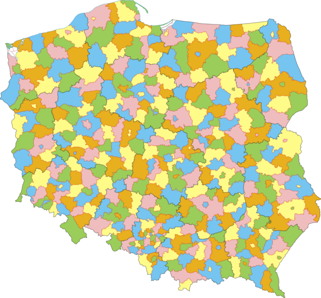
Description: Mapa administracyjna Polski z zaznaczonymi powiatami (w tym miastami na prawach powiatu) i granicami województw, stan na 1 stycznia 2007. Autor: Aotearoa Administrative map of Polish counties (powiaty) (including cities with county rights) with borders of voivodships (województwa), as of January 1, 2007. By Aotearoa
Title: POLSKA mapa powiaty2
Credit: No machine-readable source provided. Own work assumed (based on copyright claims).
Author: No machine-readable author provided. Aotearoa assumed (based on copyright claims).
Usage Terms: Creative Commons Attribution 2.5
License: CC BY 2.5
License Link: http://creativecommons.org/licenses/by/2.5
Attribution Required?: Yes
Image usage
The following page links to this image:

All content from Kiddle encyclopedia articles (including the article images and facts) can be freely used under Attribution-ShareAlike license, unless stated otherwise.