
Image: Palmdale CA and Antelope Valley and Environs Landsat7
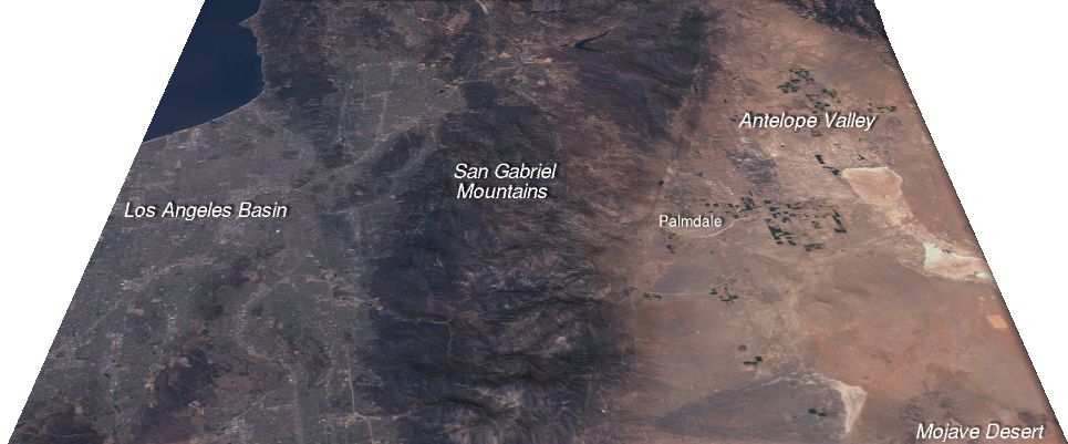
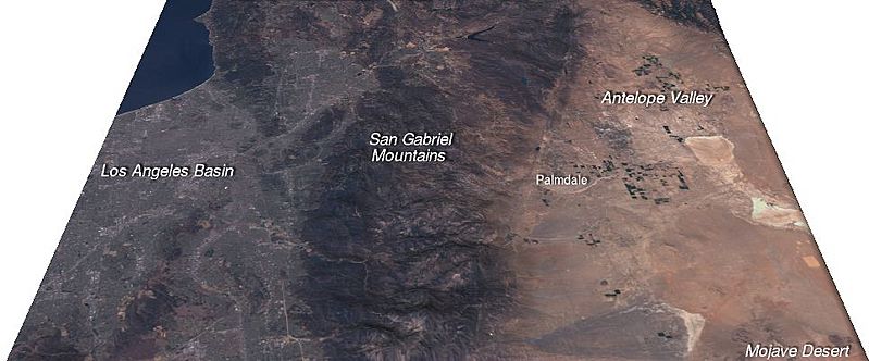
Description: Description: Landsat-7 imagery draped over digital elevation model for Palmdale, California, and environs Caption: This view looking west shows the relationship of Palmdale, to its surrounding geography. Although in the far reaches of Los Angeles County, the community of Palmdale in Antelope Valley is separated from the sprawling Los Angeles basin by the San Gabriel Mountains. (Vertical relief is exaggerated fifty percent in this image.) Source: Created for Wikipedia by wikipedian Kbh3rd using public domain data and imagery from the USGS. The image was created with 3DEM[1] and annotated with The Gimp[2].
Title: Palmdale CA and Antelope Valley and Environs Landsat7
Credit: Transferred from en.wikipedia to Commons by Fredlyfish4 using CommonsHelper.
Author: Kbh3rd at English Wikipedia
Usage Terms: Creative Commons Attribution-Share Alike 3.0
License: CC-BY-SA-3.0
License Link: http://creativecommons.org/licenses/by-sa/3.0/
Attribution Required?: Yes
Image usage
The following page links to this image:
