
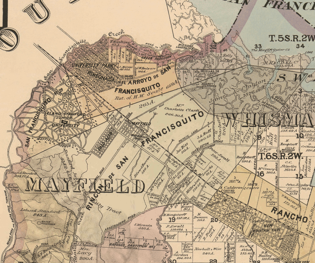
Image: Palo Alto area 1890
Description: Part of an 1890 map of northern Santa Clara county including all or part of the towns of University Park (now Palo Alto), Palo Alto (now College Terrace in Palo Alto), Mayfield (now part of Palo Alto). Also shows Stanford University (still under construction at the time)
Title: Palo Alto area 1890
Credit: Library of Congress, Official map of the County of Santa Clara, California : compiled from U.S. surveys, county records, and private surveys and the tax-list of 1889, by order of the Hon. Board of Supervisors. Published 1890 https://www.loc.gov/item/2012592102/ This is a subsection showing only Palo Alto
Author: Board of Supervisors, Santa Clara County, California Herrmann Bros. Britton & Rey.
Usage Terms: Public domain
License: Public domain
Attribution Required?: No
Image usage
The following page links to this image:
