
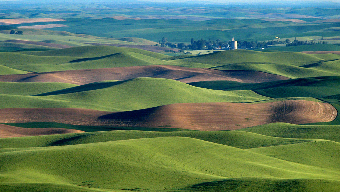
Image: Palouse hills northeast of Walla Walla
Description: We were hearing a sound like a plane and couldn't figure out where the plane was. Finally one of us spotted a yellow plane flying in the area of the grain elevator! Amazing. Steptoe Butte is the perfect high point in the Palouse Hills to catch the shadow and light play on the hills of the area at sunset and sunrise. This is a morning capture. During one of the ice ages (about 15,000 years ago) Clark Fork River (Montana) was dammed by ice, forming Missoula Lake, the top of which was about 2,000 feet in elevation. About every 2 to 60 years there was thermal erosion of the ice dam and it would collapse and let a flood go through for about 3 days -- whatever time it took to drain Missoula Lake. Many layers of silt left by multiple Missoula floods were topped by loess (dirt blown on top) which made for great rolling hills of farmlands.
Title: Palouse hills northeast of Walla Walla
Credit: Hills, grain elevator, and little yellow plane (really)
Author: Lynn Suckow from Walla Walla, WA, USA
Usage Terms: Creative Commons Attribution-Share Alike 2.0
License: CC BY-SA 2.0
License Link: http://creativecommons.org/licenses/by-sa/2.0
Attribution Required?: Yes
Image usage
The following 2 pages link to this image:
