
Image: Panoramique mont Everest
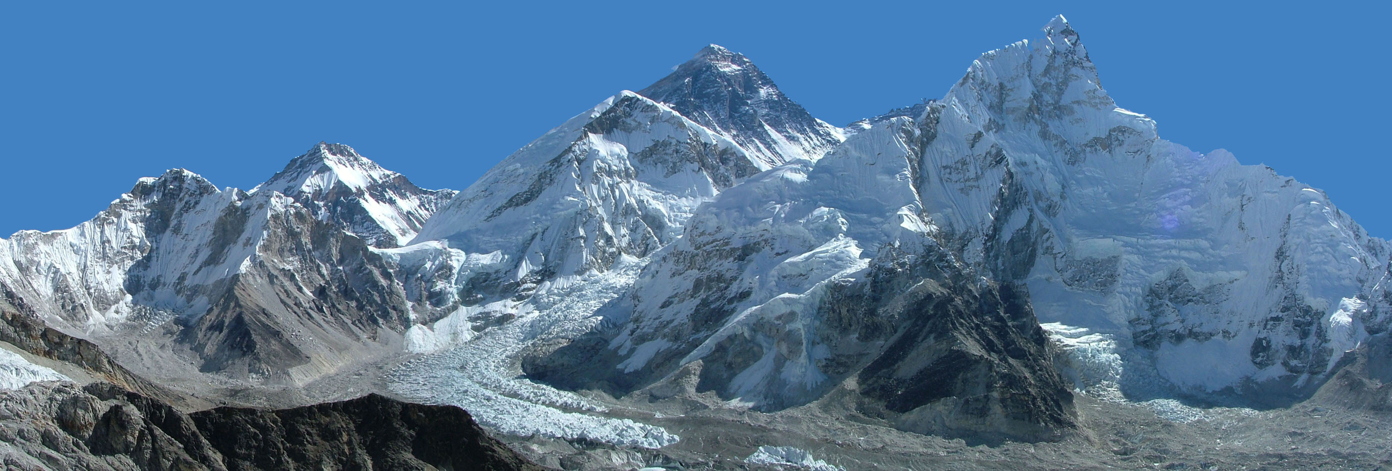
Description: Vue du Mont Everest (8850 m pyramide sombre au centre) et du Nuptse (7879 m, sommet en avant plan, à droite). Sur le flanc droit de l'Everest s'amorce le col Sud (7906 m, qui grimpe vers le Lhotse (sommet non visible sur la photo, masqué par le Nuptse). Le grand glacier qui descend de l'Everest est l'Ice Fall. Photo prise par moi-même en Octobre 2005, depuis le sommet du Kala Patthar (5545 m). Auteur : Lerian Source : Wikipédia francophone [1] Licence précisée sur Wikipédia francophone : Domaine Public View of Mount Everest (8850m -- dark pyramid in the center) and of Nuptse (7879m, the summit on the right). On the right side of Everest is the South Col (7906m), which links Everest with Lhotse (not visible, blocked by Nuptse). The large mass of broken ice arcing through the center foreground is the Khumbu Glacier. The valley through which it descends is the Western Cwm. The area below the Glacier is where Everest expeditions traveling via the Southeast Ridge establish their Base Camps. Photo shot by the uploader in October 2005, after summiting Kala Patthar (5545 m).
Title: Panoramique mont Everest
Credit: No machine-readable source provided. Own work assumed (based on copyright claims).
Author: No machine-readable author provided. Fabien1309 assumed (based on copyright claims).
Usage Terms: Public domain
License: Public domain
Attribution Required?: No
Image usage
The following page links to this image:
