
Image: Paradigma XV Provinciarum et CLV Urbium Capitalium Sinensis Imperij

Size of this preview: 423 × 599 pixels. Other resolutions: 169 × 240 pixels | 2,670 × 3,782 pixels.
Original image (2,670 × 3,782 pixels, file size: 1.94 MB, MIME type: image/jpeg)
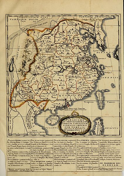
Description: "A Map of the 15 Provinces and 155 Capital Cities of the Chinese Empire", with descriptive text below, from Confucius, the Philosopher of the Chinese, Bk III, between pages 104 & 105. Note the southward course of the Yellow River (Croceus Flu.), which it followed for centuries before the 1850s floods.
Title: Paradigma XV Provinciarum et CLV Urbium Capitalium Sinensis Imperij
Credit: Internet Archive
Author: François de Louvemont
Usage Terms: Public domain
License: Public domain
Attribution Required?: No
Image usage
The following page links to this image:

All content from Kiddle encyclopedia articles (including the article images and facts) can be freely used under Attribution-ShareAlike license, unless stated otherwise.