
Image: Parinacota Volcano, South America
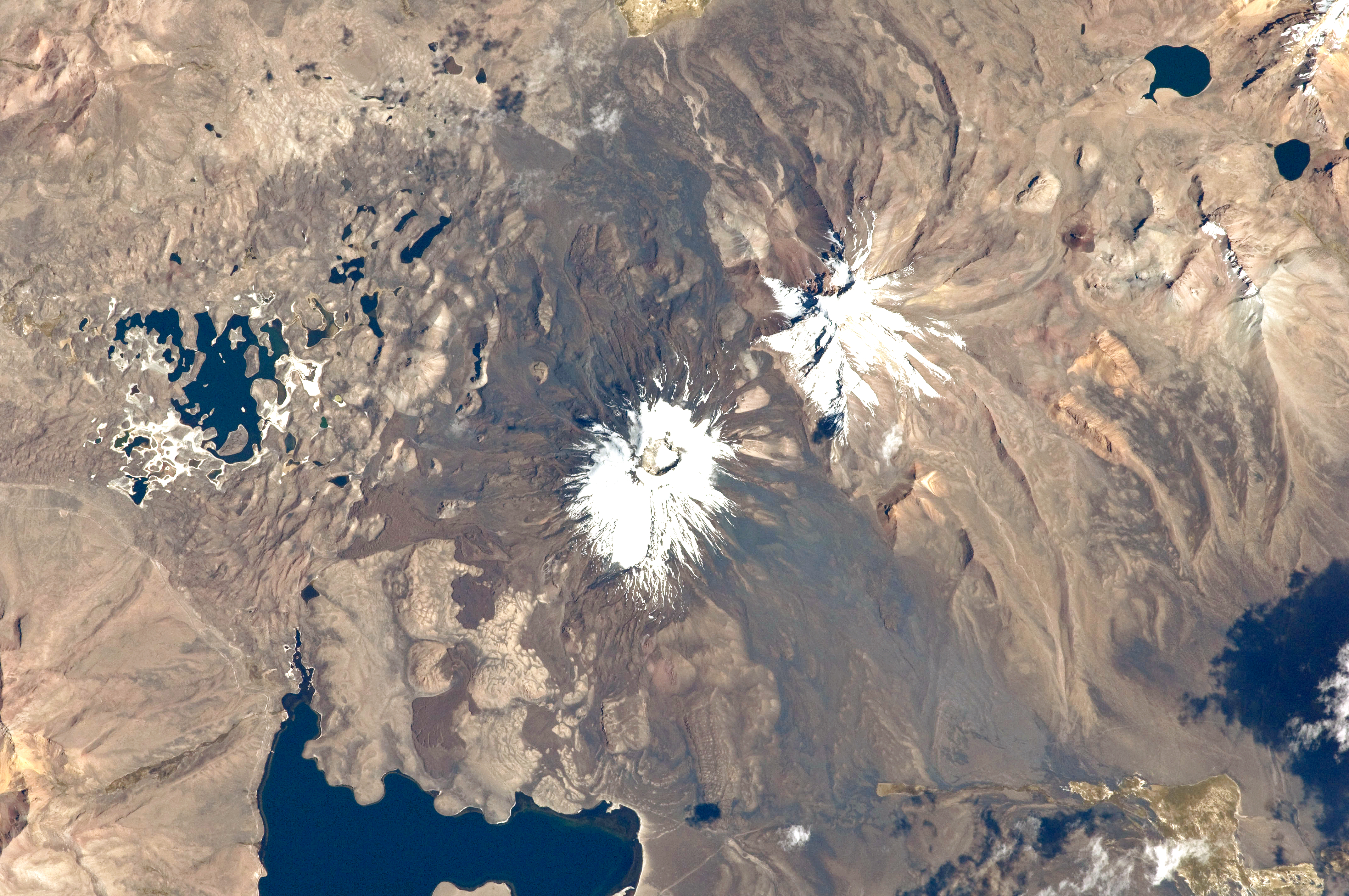
Description: This astronaut photograph from the International Space Station highlights the symmetrical cone of Parinacota, with its well-developed summit crater (elevation 6,348 meters above sea level). Dark brown to dark gray surfaces to the east and west of the summit include lava flows, pyroclastic deposits, and ash. A companion volcano, Pomerape, is located across a low saddle to the north. This volcano last erupted during the Pleistocene Epoch (approximately 3 million to 12,000 years ago). Together, Parinacota and Pomerape form the Nevados de Payachata volcanic area. The summits of both volcanoes are covered by white snowpack and small glaciers. Eruptive activity at Parinacota has directly influenced development of the local landscape, beyond the placement of volcanic deposits. Approximately 8,000 years ago, the western flank of the volcano collapsed, creating a debris avalanche that travelled 22 kilometres to the west. The debris blocked rivers and streams, leading to the formation of Chungará Lake to the south (lower left). The uneven, hummocky surface of the avalanche debris provides ample catchments for water, as evidenced by the numerous small ponds and Cotacotani Lake to the west.
Title: Parinacota Volcano, South America
Credit: NASA Earth Observatory
Author: ISS Expedition 29 crew
Usage Terms: Public domain
License: Public domain
Attribution Required?: No
Image usage
The following 2 pages link to this image:
