
Image: ParisPeace-Venizelos-Map

Size of this preview: 800 × 554 pixels. Other resolutions: 320 × 221 pixels | 912 × 631 pixels.
Original image (912 × 631 pixels, file size: 242 KB, MIME type: image/png)
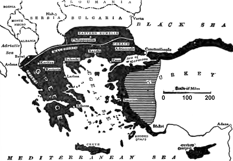
Description: WWI Paris Peace Conference Cropped caption: MAP OF GREECE, INCLUDING EPIRUS—AT THE NORTHWEST CORNER. THE BLACK AREA INDICATES THE TERRITORY CLAIMED BY M. VENIZELOS AT PARIS, AND THE SHADED AREA THE REGION WHERE THE GREEK AND FRENCH CLAIMS CONFLICT
Title: ParisPeace-Venizelos-Map
Credit: New York Times, Current History 1919
Author: NYT
Usage Terms: Public domain
License: Public domain
Attribution Required?: No
Image usage
The following 2 pages link to this image:

All content from Kiddle encyclopedia articles (including the article images and facts) can be freely used under Attribution-ShareAlike license, unless stated otherwise.