
Image: Partie de l'Amérique septent? qui comprend la Nouvelle France ou le Canada CTASC
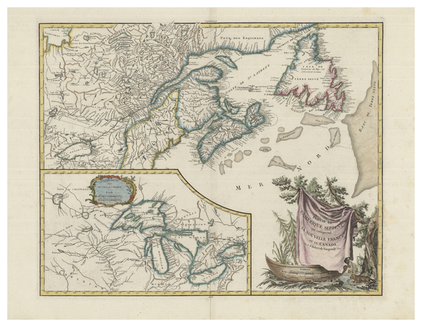
Description: French map of New France and Atlantic Canada, published around 1799. Some of Ontario (including Lake Ontario) is visible, as is some of New England. Cities, towns, provinces, territories, regions, and bodies of water are named. An inset map in the lower left shows the Great Lakes. The locations of Indigenous communities are noted throughout the map, including the Iroquois, Inuit, Wyandot, Oneida, Algonquin, and Montagnais peoples (may be listed on the map by sub-group names or incorrect names). Relief shown pictorially.
Title: Partie de l'Amérique septent? qui comprend la Nouvelle France ou le Canada
Credit: York University Libraries, Clara Thomas Archives & Special Collections, Historical map collection, HMC0003. http://digital.library.yorku.ca/islandora/object/yul:1153558
Author: Robert de Vaugondy, Gilles, 1688-1766
Usage Terms: Public domain
License: Public domain
Attribution Required?: No
Image usage
The following page links to this image:
