
Image: Pays Gallo

Size of this PNG preview of this SVG file: 800 × 564 pixels. Other resolution: 320 × 225 pixels.
Original image (SVG file, nominally 1,029 × 725 pixels, file size: 519 KB)
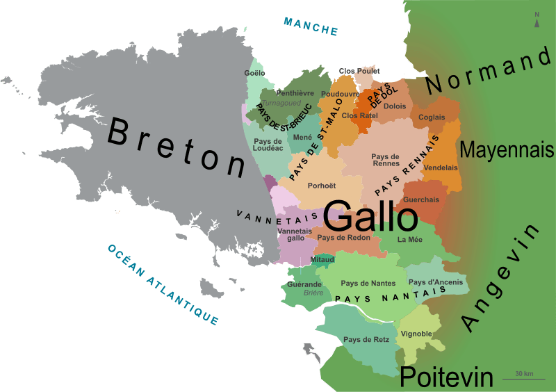
Description: Map of the Gallo speaking area in Brittany, France, with the traditional counties and neighbouring languages.
Title: Pays Gallo
Credit: Derivative works of this file: France Pays bretons map.svg, by : Pethrus
Author: Oie blanche
Usage Terms: Creative Commons Attribution-Share Alike 3.0
License: CC BY-SA 3.0
License Link: https://creativecommons.org/licenses/by-sa/3.0
Attribution Required?: Yes
Image usage
The following page links to this image:

All content from Kiddle encyclopedia articles (including the article images and facts) can be freely used under Attribution-ShareAlike license, unless stated otherwise.