
Image: Pays de la Loire region location map

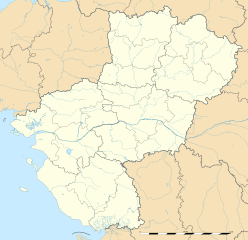
Description: Blank administrative map of the region of Pays de la Loire, France, as in February 2011, for geo-location purpose, with distinct boundaries for regions, departments and arrondissements.
Title: Pays de la Loire region location map
Credit: Own work Sources of data: NASA Shuttle Radar Topography Mission (SWBD) (public domain); NGDC World Data Bank II (public domain); Vmap-0 References for the boundaries: Préfecture de la Sarthe Préfecture de Maine-et-Loire Préfecture de Loire-Atlantique Préfecture de Vendée INSEE
Author: Eric Gaba (Sting - fr:Sting)
Permission: Attribution and Share-Alike required Any use of this map can be made as long as you credit me (Eric Gaba – Wikimedia Commons user: Sting) as the author and distribute the copies and derivative works under the same license(s) that the one(s) stated below. A message with a reply address would also be greatly appreciated.
Usage Terms: Creative Commons Attribution-Share Alike 3.0
License: CC BY-SA 3.0
License Link: http://creativecommons.org/licenses/by-sa/3.0
Attribution Required?: Yes
Image usage
More than 100 pages link to this image. The following list shows the first 100 page links to this image only. A full list is available.
- Ahuillé
- Angers
- Arçonnay
- Assé-le-Boisne
- Aubigné-Racan
- Beaumont-Pied-de-Bœuf, Sarthe
- Beaumont-sur-Sarthe
- Bernay-en-Champagne
- Bessé-sur-Braye
- Bouchamps-lès-Craon
- Bousse, Sarthe
- Bouère
- Brains-sur-Gée
- Brette-les-Pins
- Brée
- Bérus
- Béthon
- Chantenay-Villedieu
- Chemiré-le-Gaudin
- Chevillé
- Château-du-Loir
- Chérancé, Sarthe
- Chérisay
- Clermont-Créans
- Cogners
- Commerveil
- Congrier
- Conlie
- Cormes
- Couesmes-Vaucé
- Coulaines
- Coulongé
- Courdemanche, Sarthe
- Courgenard
- Degré
- Dollon
- Douillet
- Duneau
- Entrammes
- Flée, Sarthe
- Fontenay-sur-Vègre
- Gréez-sur-Roc
- Guécélard
- Javron-les-Chapelles
- Juigné-sur-Sarthe
- La Bazouge-de-Chemeré
- La Chapelle-Saint-Rémy
- La Chapelle-aux-Choux
- La Chapelle-d'Aligné
- La Chapelle-du-Bois
- La Chartre-sur-le-Loir
- La Croixille
- La Ferté-Bernard
- La Flèche
- La Pellerine, Mayenne
- La Rouaudière
- La Roë
- Landivy
- Laval (Mayenne)
- Lavaré
- Lavernat
- Le Grand-Lucé
- Le Grez
- Le Luart
- Le Mans
- Les Mées, Sarthe
- Lesbois
- Lombron
- Louailles
- Loupfougères
- Louverné
- Louvigny, Sarthe
- Luceau
- Malicorne-sur-Sarthe
- Mamers
- Maresché
- Marigné-Laillé
- Moitron-sur-Sarthe
- Moncé-en-Saosnois
- Mont-Saint-Jean, Sarthe
- Montaillé
- Montmirail, Sarthe
- Moulins-le-Carbonnel
- Mulsanne
- Mézeray, Sarthe
- Nauvay
- Nogent-le-Bernard
- Oisseau
- Olivet, Mayenne
- Peuton
- Saint-Aubin-du-Désert
- Saint-Christophe-du-Luat
- Saint-Denis-d'Anjou
- Saint-Georges-sur-Erve
- Saint-Germain-le-Fouilloux
- Saint-Loup-du-Gast
- Saint-Mars-sur-la-Futaie
- Saint-Ouën-des-Toits
- Saint-Pierre-la-Cour
- Saint-Pierre-sur-Erve
