
Image: Ph Territorial Map
Size of this preview: 584 × 600 pixels. Other resolutions: 234 × 240 pixels | 1,827 × 1,877 pixels.
Original image (1,827 × 1,877 pixels, file size: 612 KB, MIME type: image/png)
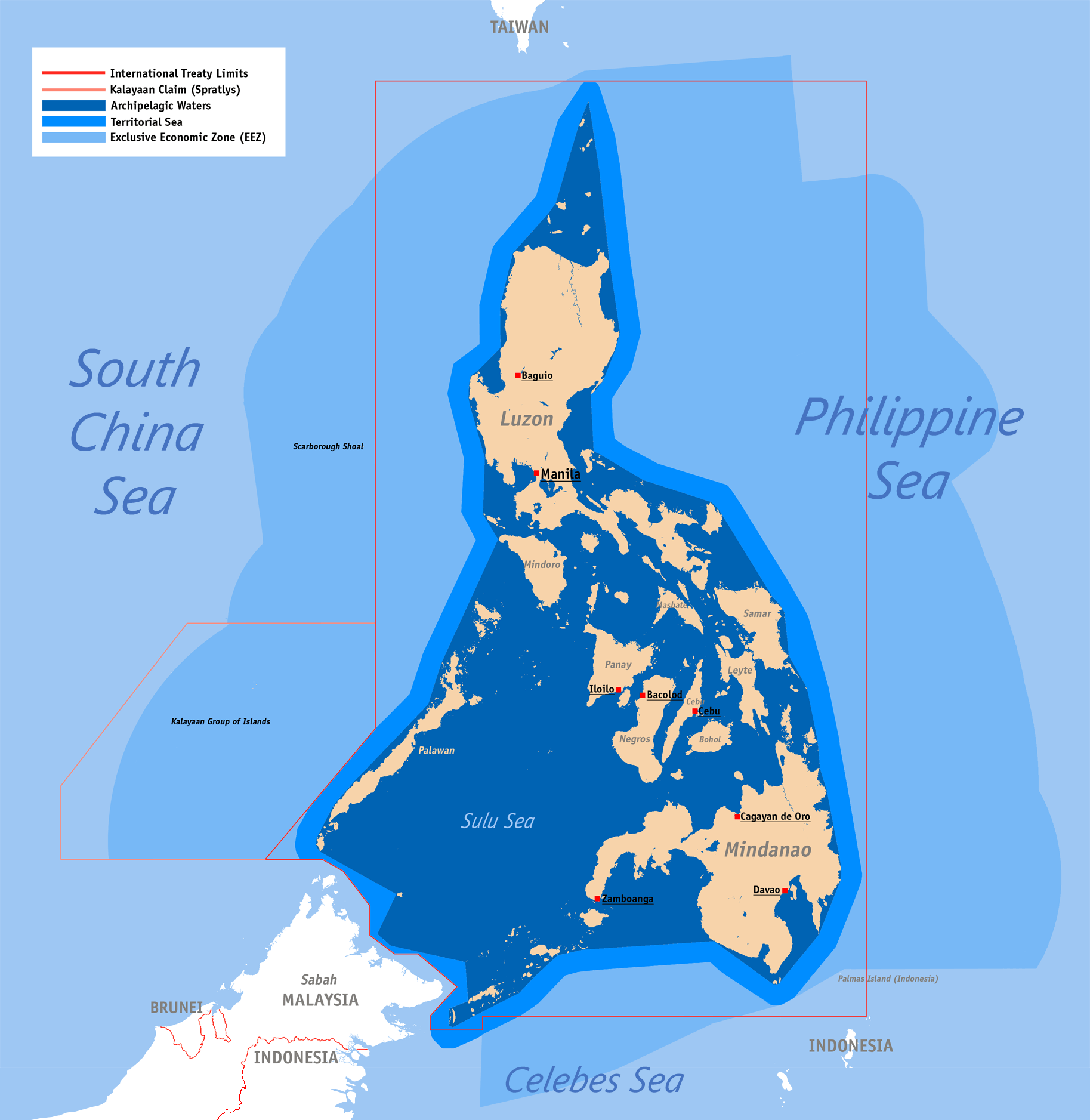
Description: Territorial map claimed by the Philippines, showing internal waters, territorial sea, international treaty limits and exclusive economic zone.
Title: Ph Territorial Map
Credit: English Wikipedia (log)
Author: Roel Balingit (username: Namayan)
Usage Terms: Creative Commons Attribution 2.5
License: CC BY 2.5
License Link: http://creativecommons.org/licenses/by/2.5
Attribution Required?: Yes
Image usage
The following 2 pages link to this image:

All content from Kiddle encyclopedia articles (including the article images and facts) can be freely used under Attribution-ShareAlike license, unless stated otherwise.