
Image: Physiographic provinces of the Mid-Atlantic region by NPS
Size of this preview: 787 × 599 pixels. Other resolutions: 315 × 240 pixels | 973 × 741 pixels.
Original image (973 × 741 pixels, file size: 74 KB, MIME type: image/png)
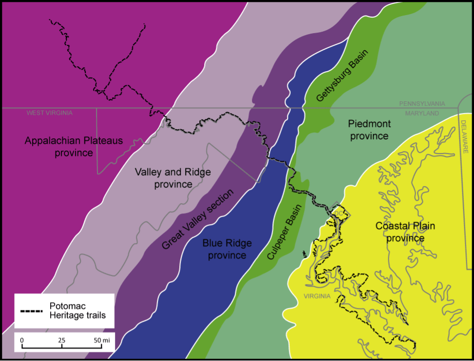
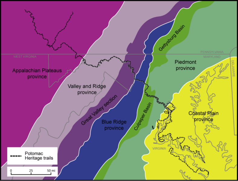
Description: Map showing the five geological provinces through which the Potomac River flows
Title: Physiographic provinces of the Mid-Atlantic region by NPS
Credit: https://www.nps.gov/pohe/learn/nature/geology.htm
Author: Katharine M Loughney
Usage Terms: Public domain
License: Public domain
Attribution Required?: No
Image usage
The following page links to this image:

All content from Kiddle encyclopedia articles (including the article images and facts) can be freely used under Attribution-ShareAlike license, unless stated otherwise.