
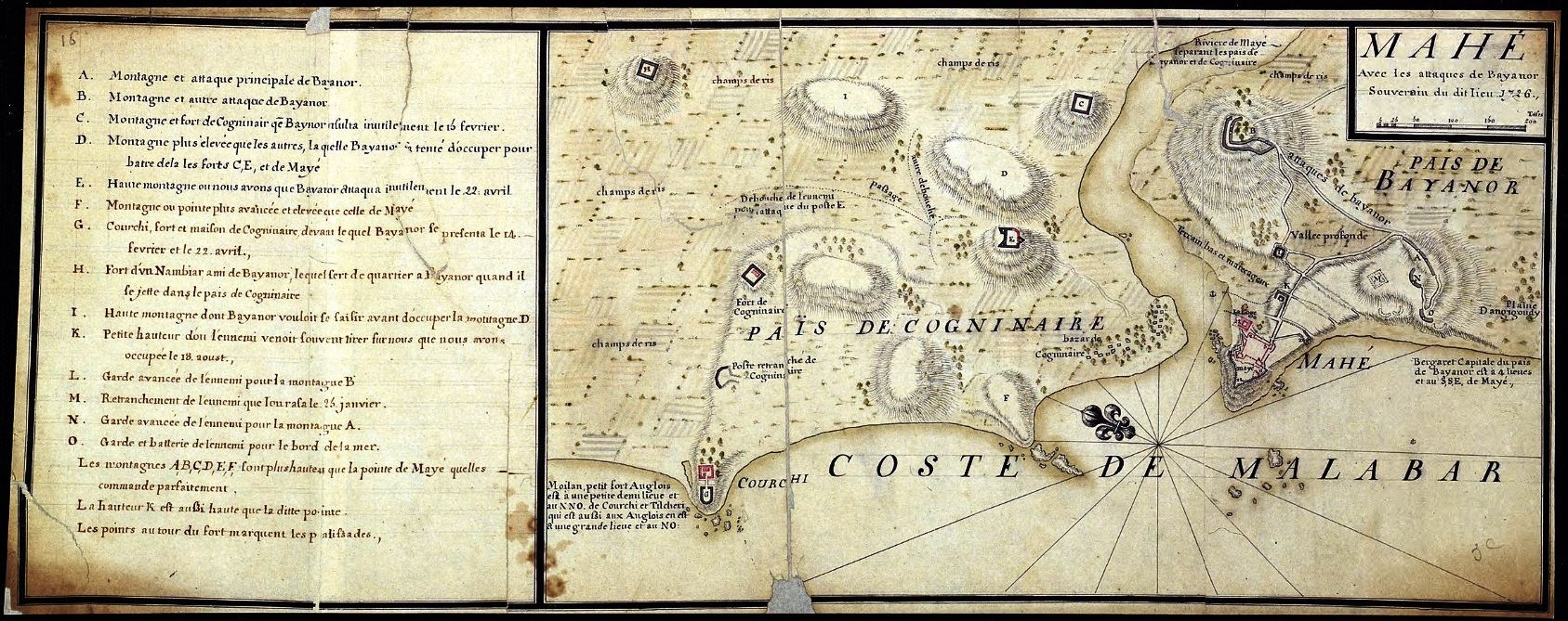
Image: Plan de Mahe avec les attaques de Bayanor souverain du lieu
Size of this preview: 800 × 317 pixels. Other resolutions: 320 × 127 pixels | 1,687 × 669 pixels.
Original image (1,687 × 669 pixels, file size: 605 KB, MIME type: image/jpeg)
Description: The French settlement of Mahé on the Malabar coast of India. Map drawn in 1726 soon after the town was recaptured from the Indian raja who, after having ceded it to the French East India Company in 1721 had taken it back by force it 1725 under the urging of the British established nearby.
Title: Plan de Mahe avec les attaques de Bayanor souverain du lieu
Credit: Archives de l'outre-mer : http://anom.archivesnationales.culture.gouv.fr/sdx/ulysse/
Author: AnonymousUnknown author
Usage Terms: Public domain
License: Public domain
Attribution Required?: No
Image usage
The following page links to this image:

All content from Kiddle encyclopedia articles (including the article images and facts) can be freely used under Attribution-ShareAlike license, unless stated otherwise.