
Image: Plan of Battle of South Mills. Dismal Swamp Canal, N.C. LOC gvhs01.vhs00080
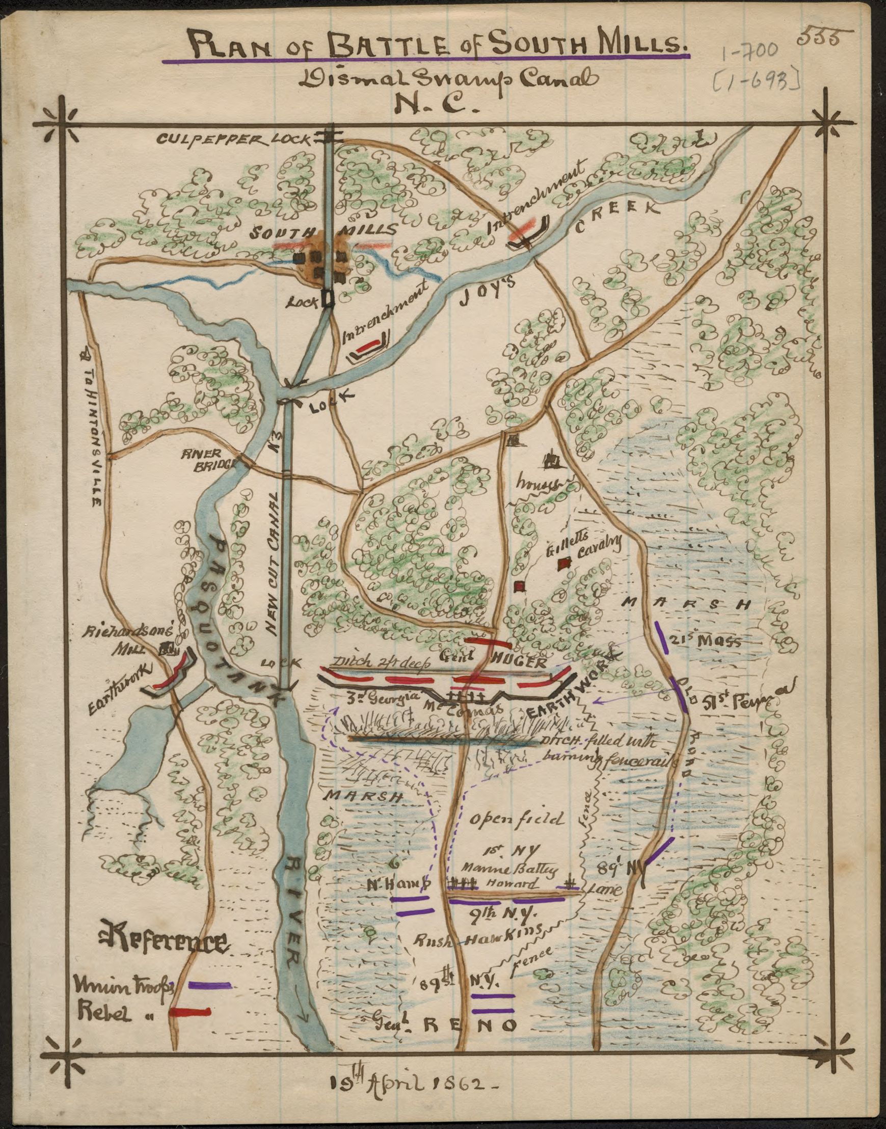
Description: Shows the area between South Mills, Camden County, N.C., and Joy's Creek to the north and the Pasquotank River to the south where a minor shirmish took place on April 19, 1862.
Title: Plan of Battle of South Mills. Dismal Swamp Canal, N.C. LOC gvhs01.vhs00080
Credit: https://www.loc.gov/item/gvhs01.vhs00080/
Author: Sneden, Robert Knox
Permission: This map is available from the United States Library of Congress's Geography & Map Division under the digital ID gvhs01.vhs00080. This tag does not indicate the copyright status of the attached work. A normal copyright tag is still required. See Commons:Licensing for more information.
Usage Terms: Public domain
License: Public domain
Attribution Required?: No
Image usage
The following page links to this image:
