
Image: Plan of Lucknow, Showing Operations in 1857-58
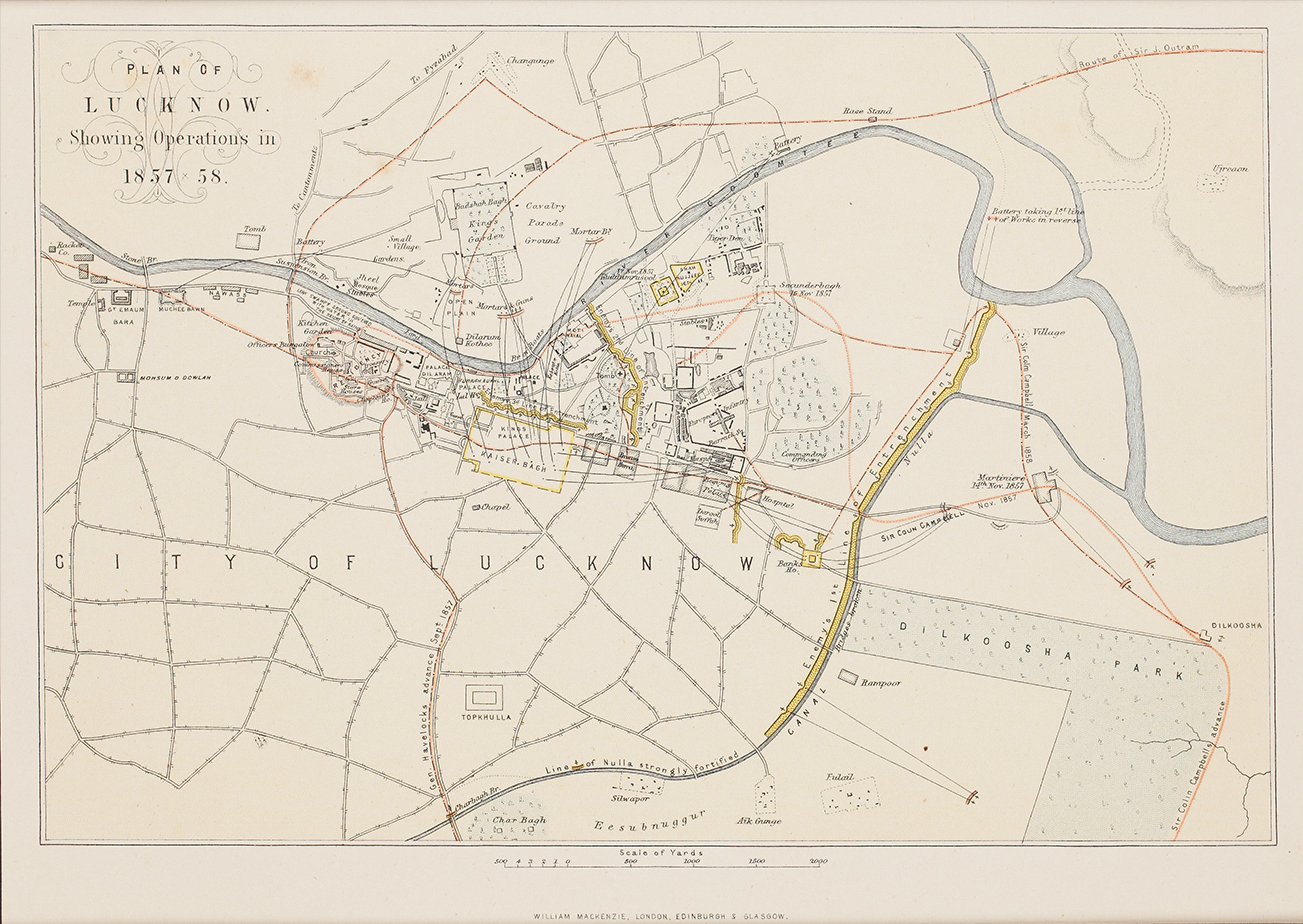
Description: Map showing Lucknow operations 1857-1858. A plan of the city of Lucknow, showing key places and buildings in the city, such as Kaiser Bagh, Residency and Dilkhoosha are marked. The red lines mark the routes of advance to relieve the city made by General Havelock, Colin Campbell and James Outram, accompanied with dates, as well as the positions of mortars and guns firing upon the enemy lines, shown in yellow.
Title: Plan of Lucknow, Showing Operations in 1857-58
Credit: https://www.sandersofoxford.com/shop/product/plan-of-lucknow-showing-operations-in-1857-58/ Originally uploaded to EN Wikipedia by en:User:HLGallon 15 March 2006
Author: Theodore Guyot, Theodore & Wood
Usage Terms: Public domain
License: Public domain
Attribution Required?: No
Image usage
The following 2 pages link to this image:
