
Image: Plan of the Tract of Land Purchased from the Mississauga Indians in 1806 CTASC
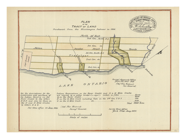
Description: Map shows the subdivisions and purchase of the Indian Reserve on the Credit River, 12 Mile, and 16 Mile Creek. While the purchase took place in 1806, this map was published by the Department of Indian Affairs in 1820. Rivers, creeks, and Lake Ontario are labelled. There is a large compass rose on the right of the map. Some large cities and towns are labelled. Text towards the bottom of the map describes the locations of Indian reserves.
Title: Plan of the Tract of Land Purchased from the Mississauga Indians in 1806
Credit: York University Libraries, Clara Thomas Archives & Special Collections, Historical map collection, HMC0050. http://digital.library.yorku.ca/islandora/object/yul:1153582
Author: Ridout, Thomas
Usage Terms: Public domain
License: Public domain
Attribution Required?: No
Image usage
The following page links to this image:
