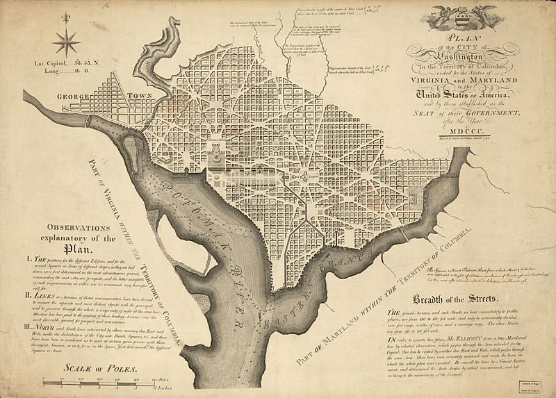
Image: Plan of the city of Washington in the territory of Columbia - ceded by the states of Virginia and Maryland to the United States of America, and by them established as the seat of their government, LOC 88694160

Description: Shows block numbers and proposed government buildings. Relief shown by hachures. Depths shown by soundings. Also covers Georgetown. Includes text, notes, and coat-of-arms. Soiled, mounted on cloth backing, edged with artificial leather stripping, partially hand col., and annotated in ink: The squares coloured Red and these from which Morris & Nicholson were excluded a right of selection ... Hamburgh. Available also through the Library of Congress Web site as a raster image. Phillips. Washington, L279 Vault DCP
Title: Plan of the city of Washington in the territory of Columbia - ceded by the states of Virginia and Maryland to the United States of America, and by them established as the seat of their government, LOC 88694160
Credit: https://www.loc.gov/item/88694160/
Author: Ellicott, Andrew; Thackara & Vallance
Permission: This map is available from the United States Library of Congress's Geography & Map Division under the digital ID g3850.ct004180. This tag does not indicate the copyright status of the attached work. A normal copyright tag is still required. See Commons:Licensing for more information.
Usage Terms: Public domain
License: Public domain
Attribution Required?: No
Image usage
The following page links to this image:

