
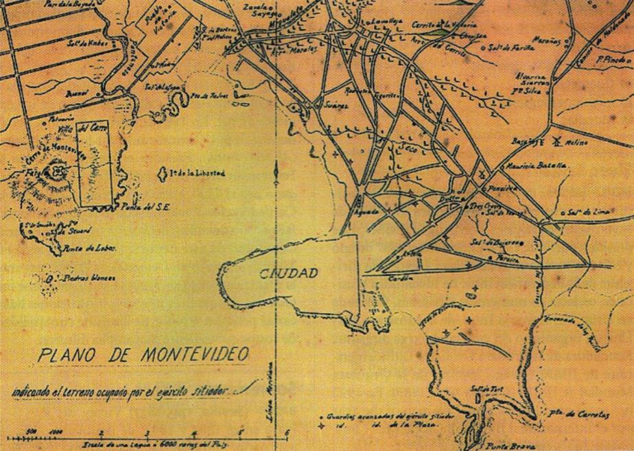
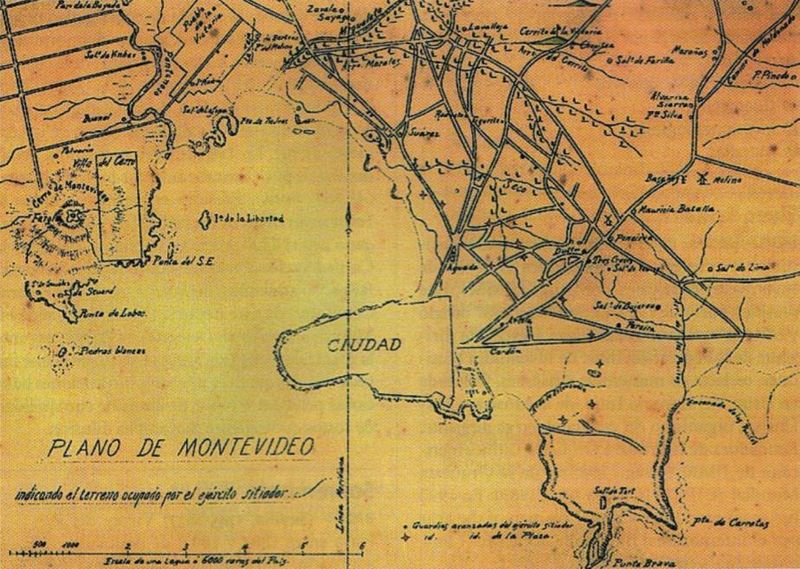
Image: PlanoMontevideoSitioGrande
Size of this preview: 800 × 569 pixels. Other resolutions: 320 × 228 pixels | 924 × 657 pixels.
Original image (924 × 657 pixels, file size: 147 KB, MIME type: image/jpeg)
Description: Former map of Montevideo (Uruguay) and surrounding towns (now converted into neighborhoods of the city), developed during the called Guerra Grande (Great War, 1843 - 1851), where the demarcation area occupied by the siege army of Montevideo.
Title: PlanoMontevideoSitioGrande
Credit: Digitalizado del libro Gran Enciclopedia del Uruguay
Author: Unknown
Usage Terms: Public domain
License: Public domain
Attribution Required?: No
Image usage
The following page links to this image:

All content from Kiddle encyclopedia articles (including the article images and facts) can be freely used under Attribution-ShareAlike license, unless stated otherwise.