
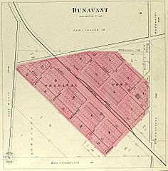
Image: Plat map of Dunavan, Descriptive atlas of Jefferson County, Kansas, 1878

Description: A plat map of Dunavan, Descriptive atlas of Jefferson County, Kansas, 1878, p. 29
Title: Plat map of Dunavan, Descriptive atlas of Jefferson County, Kansas, 1878
Credit: https://www.kansasmemory.org/item/223960/page/15
Author: Kansas Historical Society
Permission: Public domain works must be out of copyright in both the United States and in the source country of the work in order to be hosted on the Commons. If the work is not a U.S. work, the file must have an additional copyright tag indicating the copyright status in the source country. Note: This tag should not be used for sound recordings.PD-1923Public domain in the United States//commons.wikimedia.org/wiki/File:Plat_map_of_Dunavan,_Descriptive_atlas_of_Jefferson_County,_Kansas,_1878.jpg
Usage Terms: Public domain
License: Public domain
Attribution Required?: No
Image usage
The following page links to this image:
