
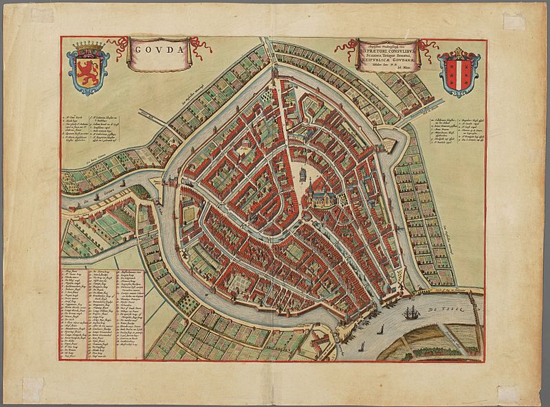
Image: Plattegrond van de stad Gouda binnen de singels, ca. 1650.

Size of this preview: 800 × 593 pixels. Other resolutions: 320 × 237 pixels | 7,584 × 5,622 pixels.
Original image (7,584 × 5,622 pixels, file size: 35.54 MB, MIME type: image/jpeg)
Description: Map of the Dutch city of Gouda, ca 1650. Afmetingen: 46 x 62 (binnenkader: 38 x 50). Techniek: koperdruk (ingekleurd)
Title: Plattegrond van de stad Gouda binnen de singels, ca. 1650.
Credit: Groene Hart Archieven. Information about copyright status (Dutch)
Author: Joh. Blaeu
Usage Terms: Public domain
License: Public domain
Attribution Required?: No
Image usage
The following page links to this image:

All content from Kiddle encyclopedia articles (including the article images and facts) can be freely used under Attribution-ShareAlike license, unless stated otherwise.