
Image: Playa Santispac - Bahía Concepción - 180 pano

Size of this preview: 800 × 231 pixels. Other resolutions: 320 × 92 pixels | 14,400 × 4,162 pixels.
Original image (14,400 × 4,162 pixels, file size: 25.24 MB, MIME type: image/jpeg)
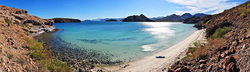
Description: 180° Panorama on Playa Santispac of Bahía Concepción, Baja California Sur. Several islands are visible in the bay: (left to right) Isla San Ramon, Isla Blanca, and Isla Coyote. On the right is Playa Concepcion with its associated developments visible. Photo by Gregg M. Erickson.
Title: Playa Santispac - Bahía Concepción - 180 pano
Credit: Own work
Author: Farwestern Photo by Gregg M. Erickson
Usage Terms: Creative Commons Attribution 3.0
License: CC BY 3.0
License Link: http://creativecommons.org/licenses/by/3.0
Attribution Required?: Yes
Image usage
The following page links to this image:

All content from Kiddle encyclopedia articles (including the article images and facts) can be freely used under Attribution-ShareAlike license, unless stated otherwise.