
Image: Point Lay Alaska DEW Line
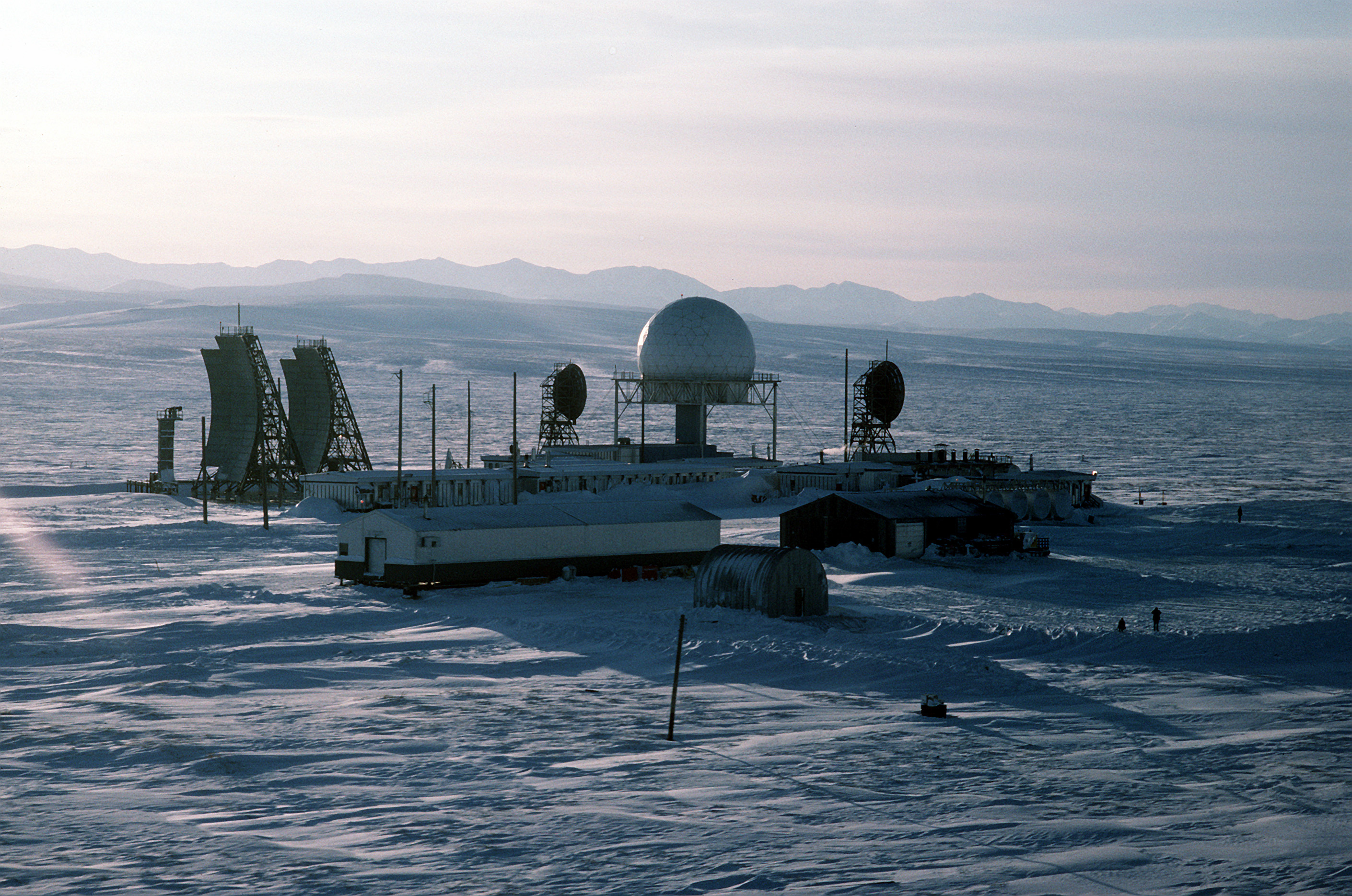
Description: An aerial view of the radar station LIZ-2, one of 30 stations under U.S. Air Force control on the Distant Early Warning (DEW) Line which runs approximately 3,600 miles, from Alaska, across Northern Canada to Greenland. Location: POINT LAY, ALASKA (AK) UNITED STATES OF AMERICA (USA)
Title: Point Lay Alaska DEW Line
Credit: ID:DFST8803446
Author: Service Depicted: Air Force Command Shown: F3203 Camera Operator: TECH. SGT. DONALD L. WETTERMAN
Permission: This image or file is a work of a U.S. Air Force Airman or employee, taken or made as part of that person's official duties. As a work of the U.S. federal government, the image or file is in the public domain in the United States. Беларуская (тарашкевіца) | Català | Čeština | Deutsch | English | Español | Eesti | فارسی | Suomi | Français | Italiano | 日本語 | 한국어 | Македонски | മലയാളം | Plattdüütsch | Nederlands | Polski | Português | Русский | Slovenčina | Slovenščina | Српски / srpski | Türkçe | Tiếng Việt | 中文 | 中文(简体) | +/−
Usage Terms: Public domain
License: Public domain
Attribution Required?: No
Image usage
The following page links to this image:
