
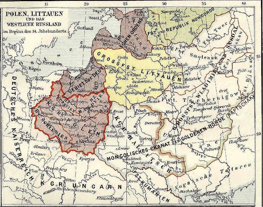
Image: Poland in the early 14th century.
Size of this preview: 760 × 599 pixels. Other resolutions: 304 × 240 pixels | 909 × 717 pixels.
Original image (909 × 717 pixels, file size: 275 KB, MIME type: image/jpeg)
Description: Map of Poland in the 14th century after the loss of Lubusz Land and temporarily loss of Pomerelia but before the loss of Silesia.
Title: Poland in the early 14th century.
Credit: Photograph of a map from Meyers Konv. Lexikon
Author: Karl Wolf
Usage Terms: Public domain
License: Public domain
Attribution Required?: No
Image usage
The following page links to this image:

All content from Kiddle encyclopedia articles (including the article images and facts) can be freely used under Attribution-ShareAlike license, unless stated otherwise.