
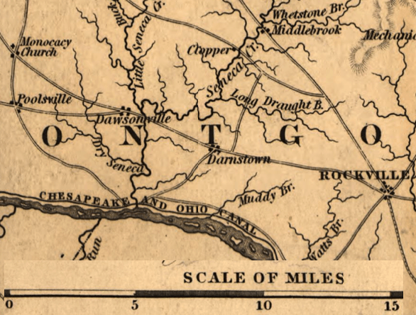
Image: Poolesville-Darnestown-Rockville MD 1841
No higher resolution available.
Poolesville-Darnestown-Rockville_MD_1841.png (586 × 444 pixels, file size: 224 KB, MIME type: image/png)
Description: This is an 1841 map of a portion of Montgomery County, Maryland, that shows the distance between Darnestown, Poolesville, Rockville, the Chesapeake & Ohio Canal, and the Potomac River
Title: Poolesville-Darnestown-Rockville MD 1841
Credit: This is two portions of an 1841 map of Maryland (also shows portions of Virginia and Delaware) by Fielding Lucas Jr. that has been modified by TwoScarsUp. The entire map can be found in the Library of Congress map.
Author: Fielding Lucas Jr. and John Ware
Usage Terms: Public domain
License: Public domain
Attribution Required?: No
Image usage
The following page links to this image:

All content from Kiddle encyclopedia articles (including the article images and facts) can be freely used under Attribution-ShareAlike license, unless stated otherwise.