
Image: Port St Louis Annotated
Size of this preview: 788 × 600 pixels. Other resolutions: 315 × 240 pixels | 1,034 × 787 pixels.
Original image (1,034 × 787 pixels, file size: 214 KB, MIME type: image/png)
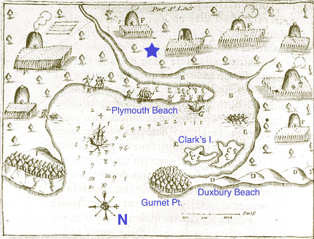
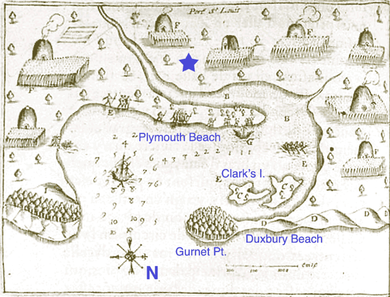
Description: Port St. Louis (w:Plymouth, Massachusetts Harbor). Original map drawn by w:Samuel de Champlain in w:1605. Modern place names added by me; star is the approximate location of initial English settlement at Plymouth.
Title: Port St Louis Annotated
Credit: Transferred from en.wikipedia to Commons by FastilyClone using MTC!.
Author: The original uploader was IMeowbot at Wikipedia.
Usage Terms: Public domain
License: Public domain
Attribution Required?: No
Image usage
The following page links to this image:

All content from Kiddle encyclopedia articles (including the article images and facts) can be freely used under Attribution-ShareAlike license, unless stated otherwise.