
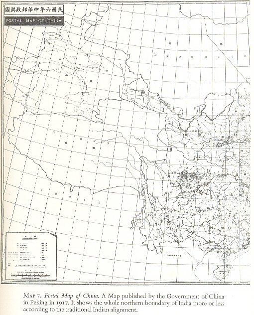
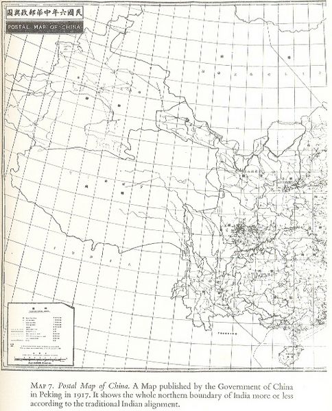
Image: Postal Map of China ,1917
Description: The “Postal map of China”, 1917, an official publication of the Government of China, published at Peking in 1917. Actually an imperialist map of China during the relevant period, the map depicts Aksai Chin, Nepal, Sikkim, and what is now Arunachal Pradesh outside Chinese territory. The source and creator of the image is the Government of China of the relevant period i.e. 1917 and the map shows that Aksai Chin and Arunachal Pradesh were not disputed, and are not Chinese territories. The map is reproduced in all “noteworthy” books pertaining to India’s border issue, including “Himalayan Frontiers” by Dorothy Woodman published inter alia by London Barrie and Rockliff The Cresset Press, 1969 at page 81.
Title: Postal Map of China ,1917
Credit: Government of China
Author: Government of China
Usage Terms: Public domain
License: Public domain
Attribution Required?: No
Image usage
The following 2 pages link to this image:
