
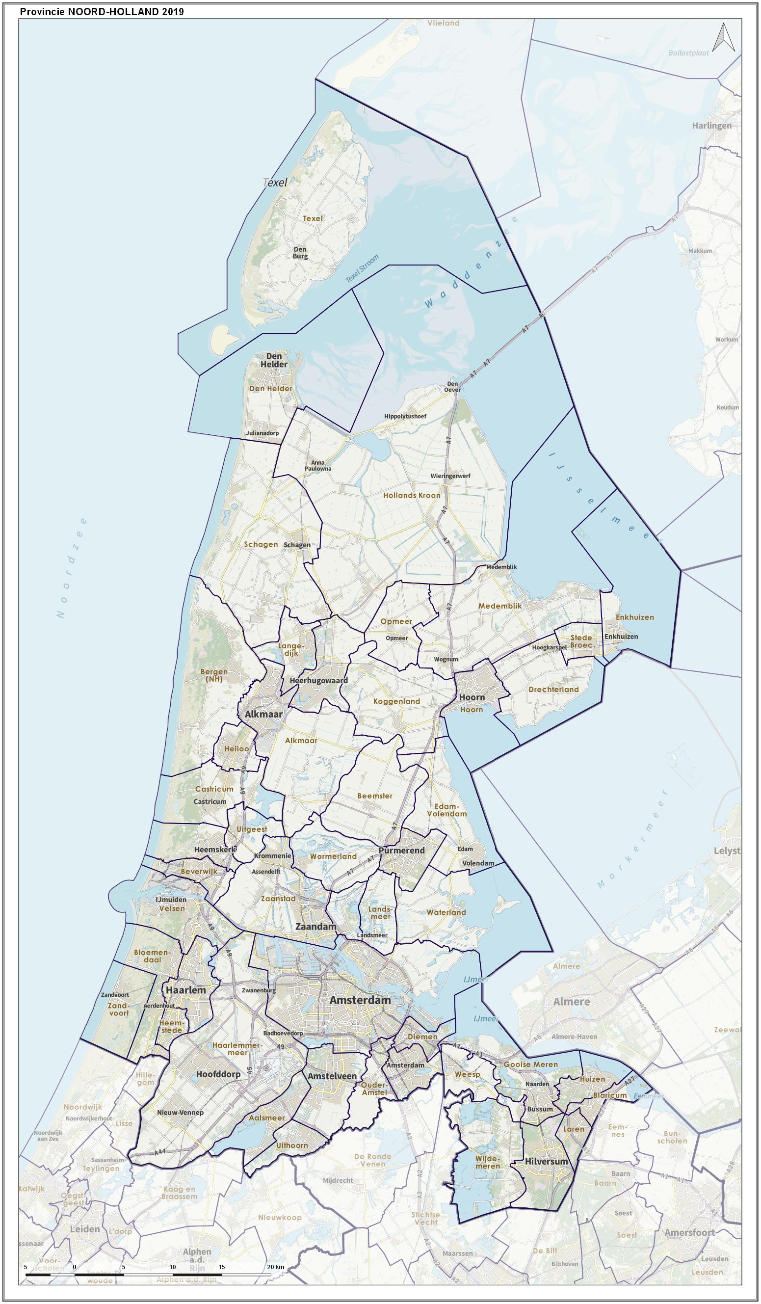
Image: Prov-Noord-Holland-OpenTopo
Size of this preview: 350 × 600 pixels. Other resolutions: 140 × 240 pixels | 1,551 × 2,657 pixels.
Original image (1,551 × 2,657 pixels, file size: 551 KB, MIME type: image/jpeg)
Description: Overview map of the province, including municipal borders, largest places and major infrastructure.
Author: Janwillemvanaalst
Usage Terms: Creative Commons Attribution-Share Alike 3.0
License: CC-BY-SA-3.0
License Link: http://creativecommons.org/licenses/by-sa/3.0/
Attribution Required?: Yes
Image usage
The following page links to this image:

All content from Kiddle encyclopedia articles (including the article images and facts) can be freely used under Attribution-ShareAlike license, unless stated otherwise.