
Image: Provinces maritimes langues

Size of this preview: 779 × 600 pixels. Other resolutions: 312 × 240 pixels | 2,535 × 1,951 pixels.
Original image (2,535 × 1,951 pixels, file size: 845 KB, MIME type: image/png)
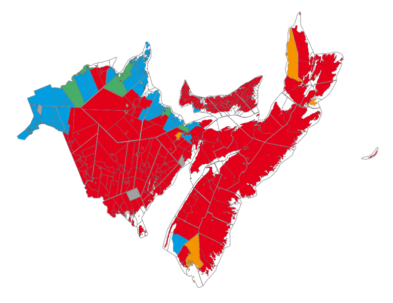
Description: Map of language in the maritimes provinces of Canada (data source : Statistics Canada, 2006 census). red - English speaking majority, less than 33% of French speaking orange - English speaking majority, more than 33% of French speaking blue - French speaking majority, less than 33% of English speaking green - French speaking majority, more than 33% of English speaking brown - allophone majority (natives) grey - no data available
Title: Provinces maritimes langues
Credit: Own work
Author: Piotron
Usage Terms: Creative Commons Attribution-Share Alike 3.0
License: CC BY-SA 3.0
License Link: http://creativecommons.org/licenses/by-sa/3.0
Attribution Required?: Yes
Image usage
The following page links to this image:

All content from Kiddle encyclopedia articles (including the article images and facts) can be freely used under Attribution-ShareAlike license, unless stated otherwise.