
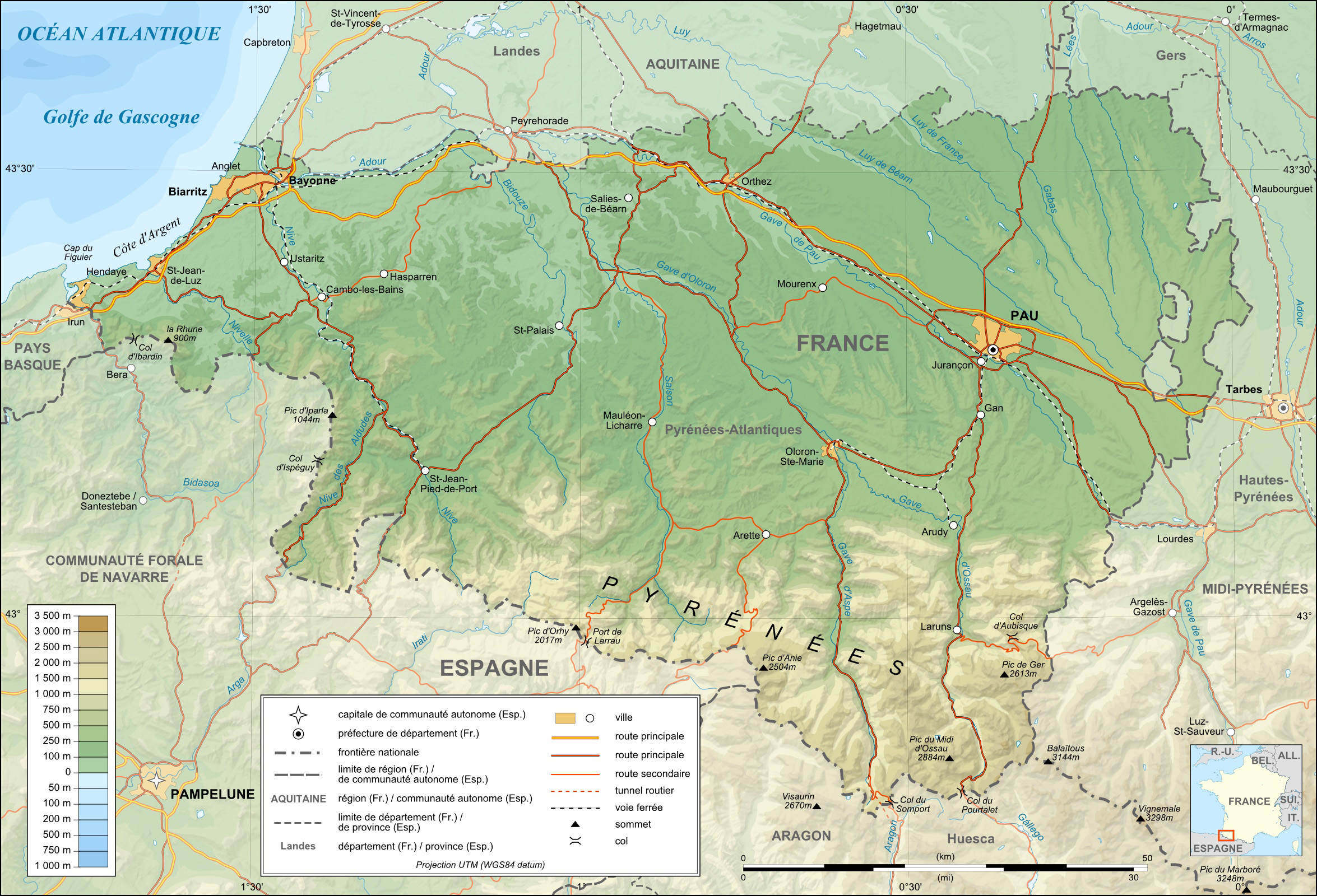
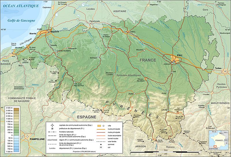
Image: Pyrenees-Atlantiques topographic map-fr
Description: Topographic map in French of the department of the Pyrénées-Atlantiques This is a lighter raster JPG format version of Image:Pyrenees-Atlantiques_topographic_map-fr.svg which should be used in the article pages, the vector graphics version purpose being for modification and / or translation. Approximate scales : * Topographic data : 1:400,000 (accuracy : about 100 m) ; * Bathymetry : 1:4 000 000 (accuracy : about 1,000 m)
Title: Pyrenees-Atlantiques topographic map-fr
Credit: Own work (see complete description on Image:Pyrenees-Atlantiques_topographic_map-fr.svg).
Author: Eric Gaba (Sting - fr:Sting)
Permission: Attribution and Share-Alike required Any use of this map can be made as long as you credit me (Eric Gaba – Wikimedia Commons user: Sting) as the author and distribute the copies and derivative works under the same license(s) that the one(s) stated below. A message with a reply address would also be greatly appreciated.
Usage Terms: GNU Free Documentation License
License: GFDL
License Link: http://www.gnu.org/copyleft/fdl.html
Attribution Required?: Yes
Image usage
The following page links to this image:
