
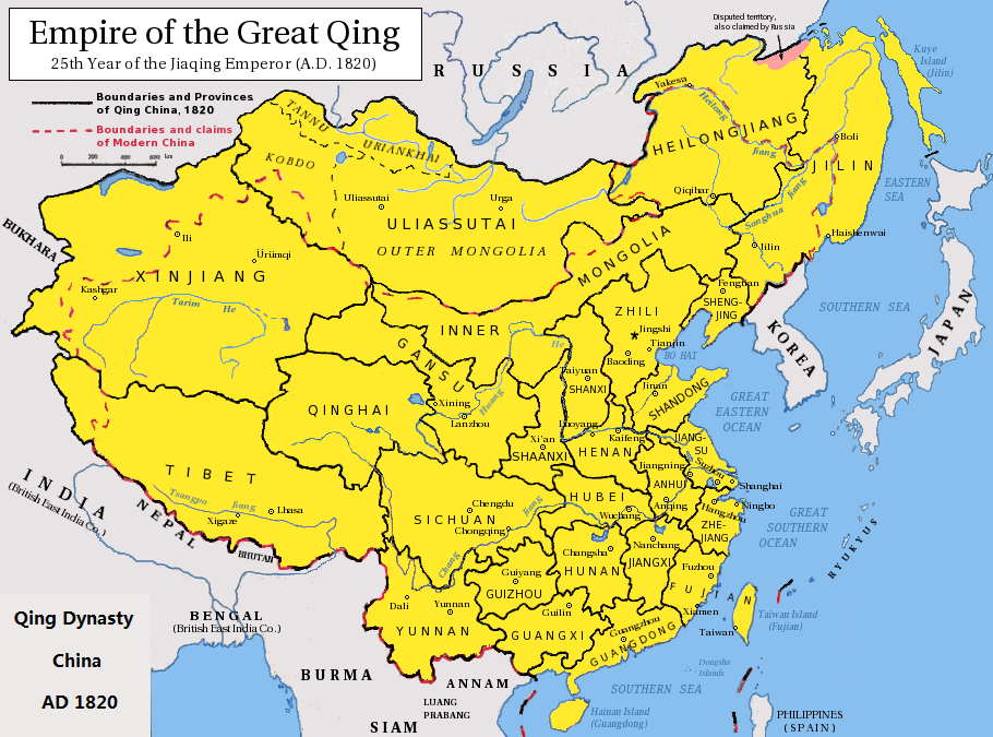
Image: Qing China 1820
Description: Map of the Qing Dynasty China in 1820. (Includes provincial boundaries and the boundaries of modern China for reference.) Adapted from http://en.wikipedia.org/wiki/Image:ROC_PRC_comparison_eng.jpg and information complied from other sources such as http://baike.baidu.com/view/5405.htm , http://map.huhai.net/58-59.jpg and http://www.sina7.com/jdwh/UploadFiles_6109/200709/20070918093610860.jpg
Title: Qing China 1820
Credit: Qing_Dynasty_1820.png (derivative work)
Author: Qing_Dynasty_1820.png: Pryaltonian derivative work: Wengier (talk)
Usage Terms: Creative Commons Attribution-Share Alike 3.0
License: CC BY-SA 3.0
License Link: https://creativecommons.org/licenses/by-sa/3.0
Attribution Required?: Yes
Image usage
The following 2 pages link to this image:
