
Image: Qing Dynasty 1820
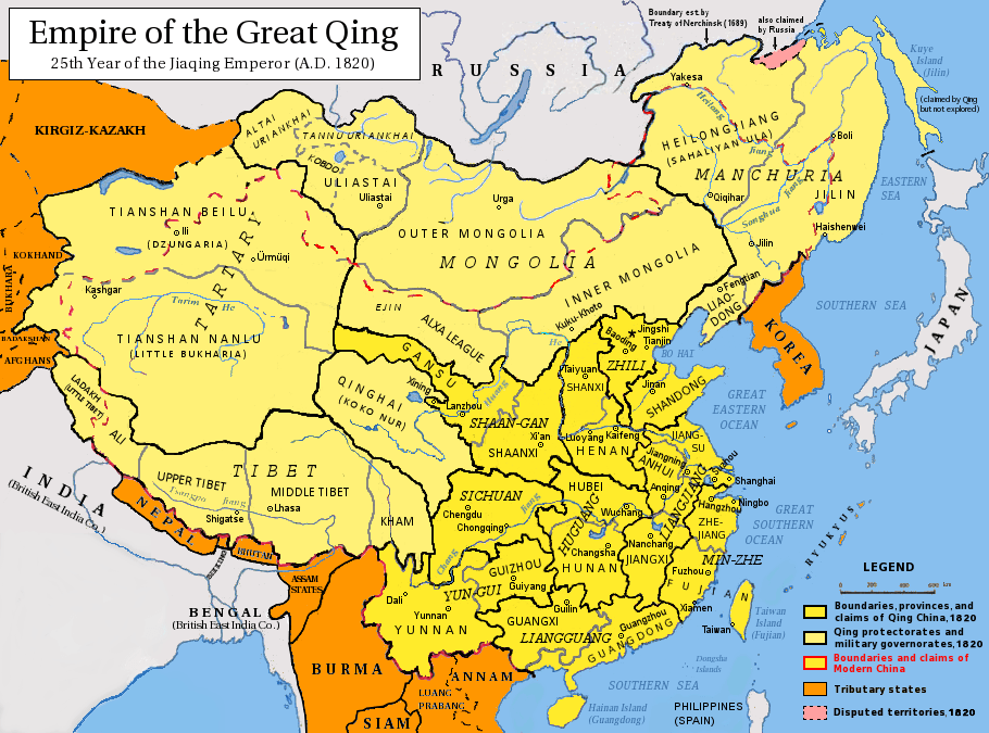
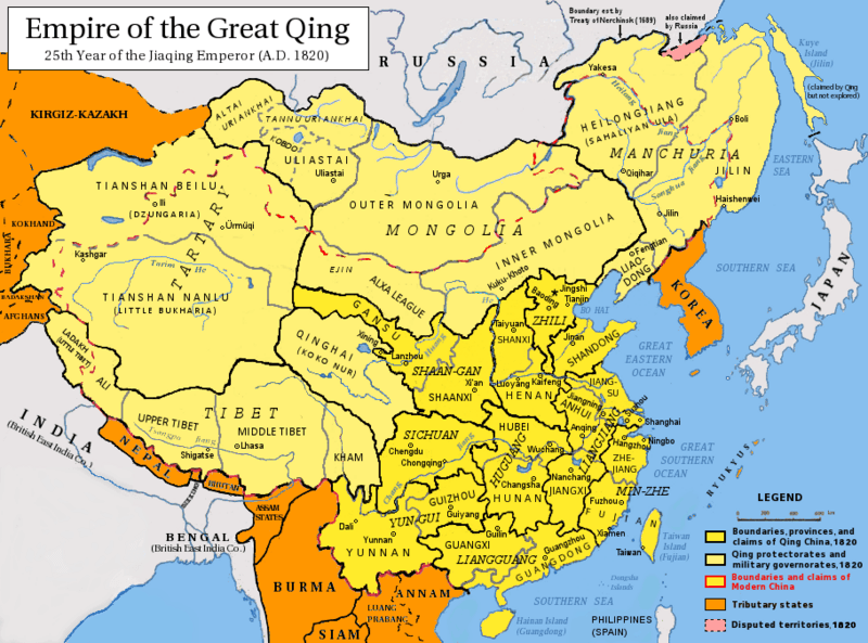
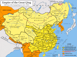
Description: Map of the Qing Dynasty in 1820. (Includes provincial boundaries and the boundaries of modern China for reference.) Provinces in yellow, military governorates and protectorates in light yellow, tributary states in orange. Adapted from http://en.wikipedia.org/wiki/Image:ROC_PRC_comparison_eng.jpg and information complied from: http://baike.baidu.com/view/5405.htm http://map.huhai.net/58-59.jpg http://www.sina7.com/jdwh/UploadFiles_6109/200709/20070918093610860.jpg http://upload.wikimedia.org/wikipedia/commons/c/c4/China_and_Japan%2C_John_Nicaragua_Dower_%281844%29.jpg http://upload.wikimedia.org/wikipedia/commons/d/d9/Carte_generale_de_l%27Empire_Chinois_et_du_Japon_%281836%29.jpg http://upload.wikimedia.org/wikipedia/commons/6/6e/Empire_Chinois%2C_Japon_%281832%29.jpg http://upload.wikimedia.org/wikipedia/commons/a/af/L%27Empire_Chinois_et_du_Japon_%281833%29.jpg http://city.udn.com/3011/4192243?tpno=48&cate_no=0 http://bbs.godeyes.cn/showtopic-371673.aspx
Title: Qing Dynasty 1820
Credit: Own work
Author: Pryaltonian
Usage Terms: Creative Commons Attribution-Share Alike 3.0
License: CC BY-SA 3.0
License Link: http://creativecommons.org/licenses/by-sa/3.0
Attribution Required?: Yes
Image usage
The following 3 pages link to this image:
